alb4055419
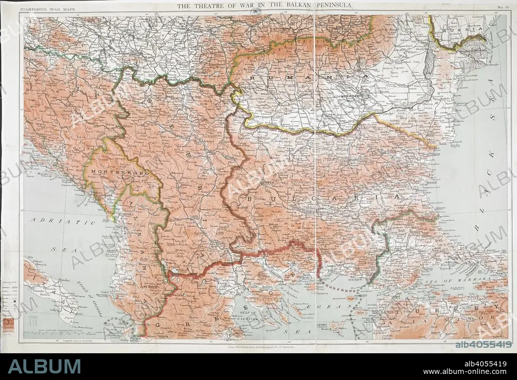
First World War map of the Balkan peninsula, 1916. Stanford's War Maps. No. 14. The Seat of War in the Balkan peninsula. Scale, 1 : 1,140,000 = 18 English miles to 1 inch. 9 March 1916. Source: Maps.1035.(90) no.16.
| Compartir |
|---|
 Pinterest Pinterest |
 Twitter Twitter |
 Facebook Facebook |
 Copiar enlace Copiar enlace |
 Email Email |
|
Añadir a otro lightbox |
|
Añadir a otro lightbox |


¿Ya tienes cuenta? Iniciar sesión
¿No tienes cuenta? Regístrate
Compra esta imagen.
Selecciona el uso:

Descripción:
Ver traducción automática
First World War map of the Balkan peninsula, 1916. Stanford's War Maps. No. 14. The Seat of War in the Balkan peninsula. Scale, 1 : 1,140,000 = 18 English miles to 1 inch. 9 March 1916. Source: Maps.1035.(90) no.16.
Crédito:
Album / British Library
Autorizaciones:
Tamaño imagen:
8481 x 5800 px | 140.7 MB
Tamaño impresión:
71.8 x 49.1 cm | 28.3 x 19.3 in (300 dpi)
Palabras clave:
1ª GUERRA MUNDIAL • ACONTECIMIENTO • BALCANES • CARTOGRAFIA • CARTOGRAFICO • COMBATE • CONFLICTO ARMADO • CONFLICTO BELICO • CONFLICTOS ARMADOS • EUROPA • EVENTO MILITAR • EVENTOS MILITARES • GRAFICO • GRAN GUERRA • GUERRA MUNDIAL I 1914/18 • GUERRA MUNDIAL I • GUERRA MUNDIAL • GUERRA • GUERRAS • MAPA • MAPAS • PRIMERA GUERRA MUNDIAL 1914/18 • PRIMERA GUERRA MUNDIAL • S. XX • SIGLO XX • SUR DE EUROPA • WAR • WW1
