alb4011016
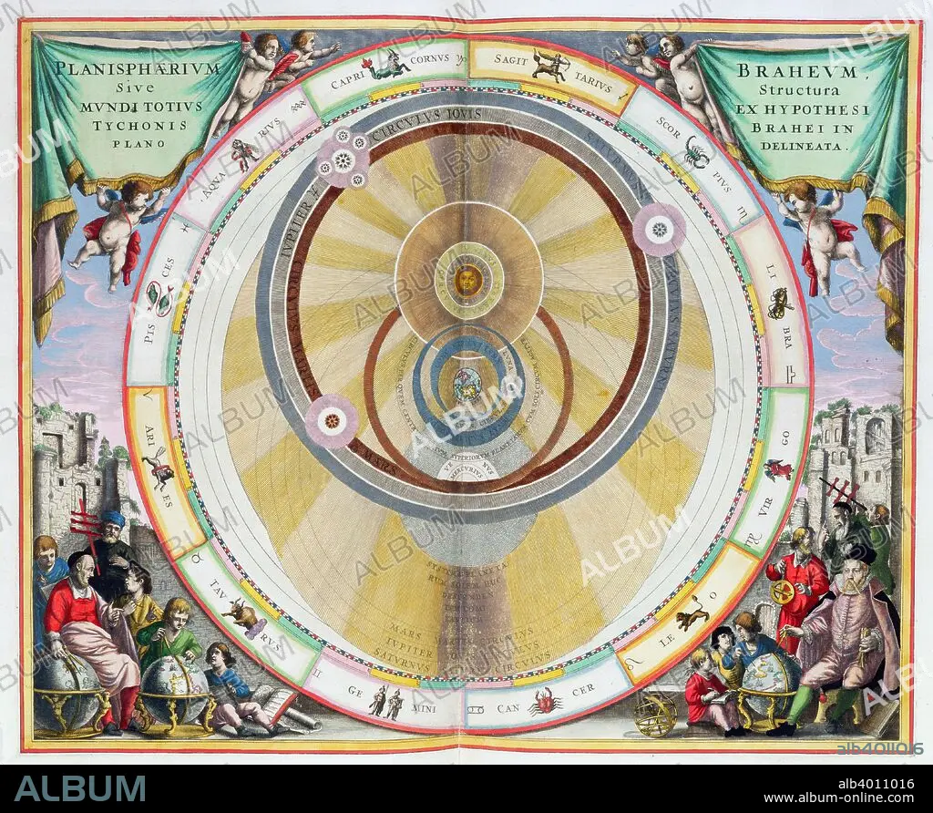
Map showing Tycho Brahe's system of planetary orbits, 1660-1661. Artist: Andreas Cellarius
| Compartir |
|---|
 Pinterest Pinterest |
 Twitter Twitter |
 Facebook Facebook |
 Copiar enlace Copiar enlace |
 Email Email |
|
Añadir a otro lightbox |
|
Añadir a otro lightbox |


¿Ya tienes cuenta? Iniciar sesión
¿No tienes cuenta? Regístrate
Compra esta imagen

Título:
Map showing Tycho Brahe's system of planetary orbits, 1660-1661. Artist: Andreas Cellarius
Descripción:
Ver traducción automática
Map showing Tycho Brahe's system of planetary orbits, 1660-1661. From The Celestial Atlas, or The Harmony of the Universe (Atlas coelestis seu harmonia macrocosmica) by Andreas Cellarius, published by Johannes Janssonius, (Amsterdam 1660-1661).
Crédito:
Album / Heritage Images / Historica Graphica Collection
Autorizaciones:
Modelo: No - Propiedad: No
¿Preguntas relacionadas con los derechos?
¿Preguntas relacionadas con los derechos?
Tamaño imagen:
4648 x 3809 px | 50.7 MB
Tamaño impresión:
39.4 x 32.2 cm | 15.5 x 12.7 in (300 dpi)
Palabras clave:
ANDREAS CELLARIUS • ASTROLOGIA • ASTRONOMIA • CIENCIA • COLOR • DINAMARCA • ESPACIAL • ESPACIALES • ESPACIO • GENTE • GRABADO • HOLANDA • HOLANDES • MAPA • ORBITA • PAÍS • PLANETA TIERRA • PLANETA • SIGLO XVII • SIGLO • SISTEMA SOLAR • TEORIA
