alb3828222
Typhoon, Navy Ship Radar
| Compartir |
|---|
 Pinterest Pinterest |
 Twitter Twitter |
 Facebook Facebook |
 Copiar enlace Copiar enlace |
 Email Email |
|
Añadir a otro lightbox |
|
Añadir a otro lightbox |


¿Ya tienes cuenta? Iniciar sesión
¿No tienes cuenta? Regístrate
Compra esta imagen.
Selecciona el uso:

Título:
Typhoon, Navy Ship Radar
Descripción:
Ver traducción automática
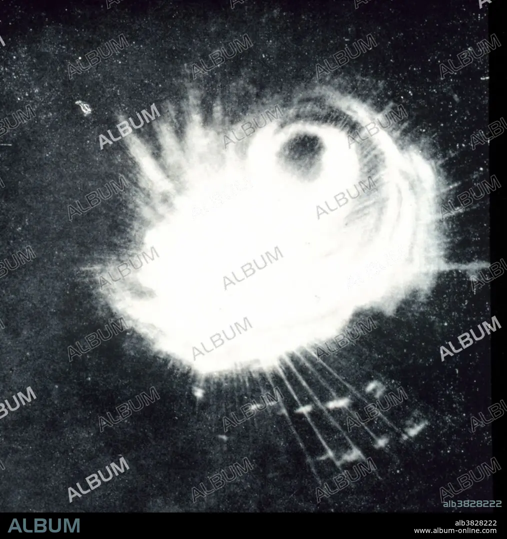
Structure of a typhoon captured by a Navy ship's radar. This storm was the second tropical storm to ever be observed on radar. Philippine Islands, area to east. December 18, 1944. A typhoon is a tropical cyclone or hurricane of the western Pacific area and the China seas.
Crédito:
Album / NOAA/Science Source
Autorizaciones:
Modelo: No - Propiedad: No
¿Preguntas relacionadas con los derechos?
¿Preguntas relacionadas con los derechos?
Tamaño imagen:
3300 x 3334 px | 31.5 MB
Tamaño impresión:
27.9 x 28.2 cm | 11.0 x 11.1 in (300 dpi)
Palabras clave:
1944 • AMERICA • AMERICANO • ATMOSFERICO • BLANCO Y NEGRO • CIENCIA • CLIMA • ESTADOS UNIDOS DE AMERICA • ESTADOS UNIDOS • FENÓMENO NATURAL • FENOMENOS NATURALES • HISTORIA • HISTORICO • ISLA • MARINA (EJERCITO) • METEOROLOGÍA • METEOROLÓGICO • METEREOLOGIA • METEREOLÓGICOS • MILITAR • S. XX • SIGLO XX • TORMENTA • VIOLENTOS
