alb3123202
Berlin Blockade Map.
| Compartir |
|---|
 Pinterest Pinterest |
 Twitter Twitter |
 Facebook Facebook |
 Copiar enlace Copiar enlace |
 Email Email |
|
Añadir a otro lightbox |
|
Añadir a otro lightbox |


¿Ya tienes cuenta? Iniciar sesión
¿No tienes cuenta? Regístrate
Compra esta imagen.
Selecciona el uso:

Título: Berlin Blockade Map.
Descripción: Ver traducción automática
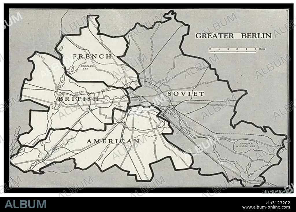
Berlin Blockade Map 1948. The Berlin Blockade (1 April 1948 – 12 May 1949) was one of the first major international crises of the Cold War. During the multinational occupation of post–World War II Germany, the Soviet Union blocked the Western Allies' railway, road, and canal access to the sectors of Berlin under Western control.
Berlin Blockade Map 1948. The Berlin Blockade (1 April 1948 – 12 May 1949) was one of the first major international crises of the Cold War. During the multinational occupation of post–World War II Germany, the Soviet Union blocked the Western Allies' railway, road, and canal access to the sectors of Berlin under Western control.
Crédito: Album / Universal Images Group / Universal History Archive
Autorizaciones: ? Cesión de modelo: No - ? Cesión de propiedad: No
¿Preguntas relacionadas con los derechos?
¿Preguntas relacionadas con los derechos?
Tamaño imagen: 5100 × 3386 px | 49.4 MB
Tamaño impresión: 43.2 × 28.7 cm | 2007.9 × 1333.1 in (300 dpi)
Palabras clave: 1940 • 2ª GUERRA MUNDIAL • ALEMANIA • BERLIN • CAMINO • CANAL • CARRETERA • CONFLICTO BELICO • CRISIS • FERROCARRIL • GUERRA (2ª GUERRA MUNDIAL) • GUERRA FRIA • GUERRA MUNDIAL II 1939/45 • GUERRA • GUERRAS • II GUERRA MUNDIAL • MAPA • MAPAS • OCCIDENTAL • OCUPACION • S. XX • SEGUNDA GUERRA MUNDIAL 1939/45 • SEGUNDA GUERRA MUNDIAL • SIGLO XX • UNION SOVIETICA • WAR
