alb4951483
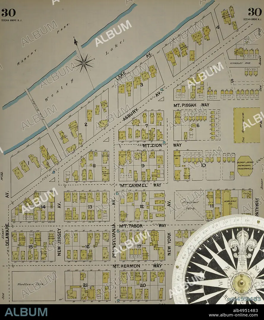
Image 31 of Sanborn Fire Insurance Map from New Jersey Coast, New Jersey Coast, New Jersey. 1890 Vol. 4. 42 Sheet(s). Includes Anglesea, Avalon, Cape May, Cape May Point, Holly Beach City, Mount Vernon, New Mount Vernon, Ocean City, Sea Isle City, Shellingers Landing, West Cape May, Wildwood Beach. Bound, America, street map with a Nineteenth Century compass.
| Compartir |
|---|
 Pinterest Pinterest |
 Twitter Twitter |
 Facebook Facebook |
 Copiar enlace Copiar enlace |
 Email Email |
|
Añadir a otro lightbox |
|
Añadir a otro lightbox |


¿Ya tienes cuenta? Iniciar sesión
¿No tienes cuenta? Regístrate
Compra esta imagen

Descripción:
Ver traducción automática
Image 31 of Sanborn Fire Insurance Map from New Jersey Coast, New Jersey Coast, New Jersey. 1890 Vol. 4. 42 Sheet(s). Includes Anglesea, Avalon, Cape May, Cape May Point, Holly Beach City, Mount Vernon, New Mount Vernon, Ocean City, Sea Isle City, Shellingers Landing, West Cape May, Wildwood Beach. Bound, America, street map with a Nineteenth Century compass
Crédito:
Album / quintlox
Autorizaciones:
Modelo: No - Propiedad: No
¿Preguntas relacionadas con los derechos?
¿Preguntas relacionadas con los derechos?
Tamaño imagen:
5000 x 5761 px | 82.4 MB
Tamaño impresión:
42.3 x 48.8 cm | 16.7 x 19.2 in (300 dpi)
Palabras clave:
4 • AL AIRE LIBRE • AMERICA • CALLE • CARTOGRAFIA • CIUDAD • EDAD • ESTADOS UNIDOS • GEOGRAFIA • NEW JERSEY • NUEVA JERSEY • OBLIGADOS • OUTSIDE • POR CARRETERA • PUNTO DE REFERENCIA • URBANO • VIAJE • VINTAGE
