alb4071537
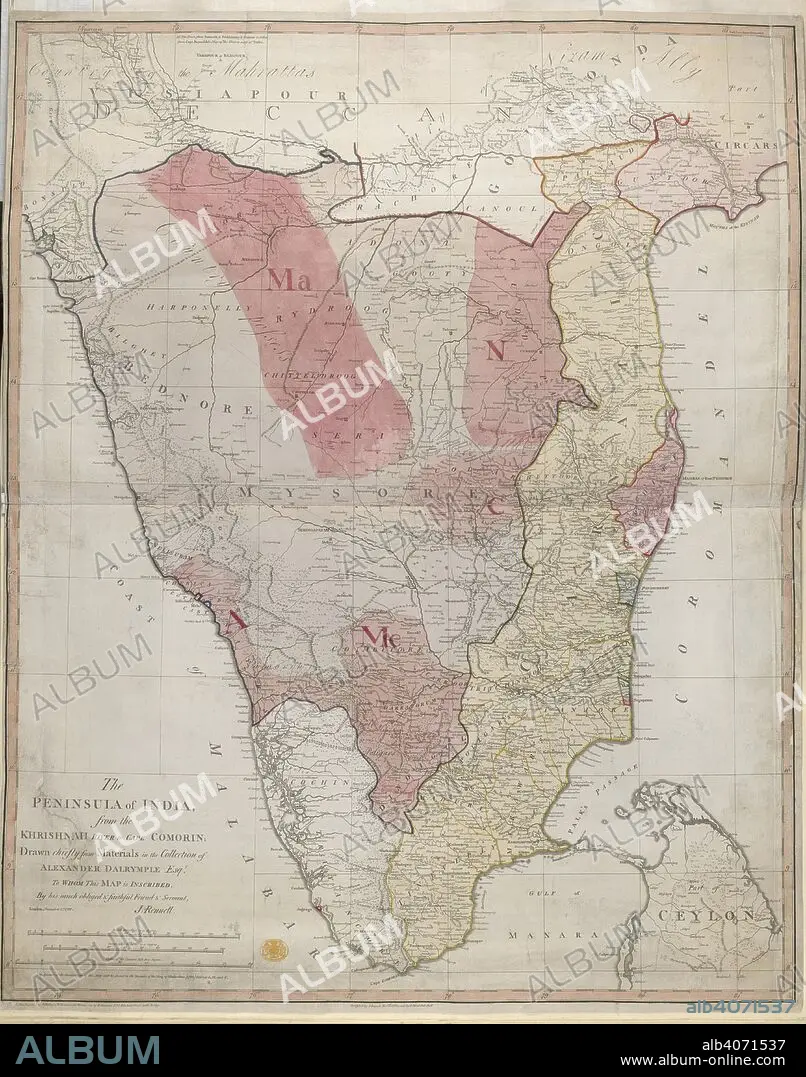
JAMES RENNELL. Peninsula of India. The Peninsula of India from the India from the Kri. 1788. Map of The Peninsula of India from the India from the Krishnah River to Cape Comorin. Image taken from The Peninsula of India from the India from the Krishnah River to Cape Comorin, drawn chiefly from materials in the collection of Alexr Dalrymple, Esq., by J. Rennell. Originally published/produced in 1788. . Source: Maps.K.Top.115.65,.
| Compartir |
|---|
 Pinterest Pinterest |
 Twitter Twitter |
 Facebook Facebook |
 Copiar enlace Copiar enlace |
 Email Email |
|
Añadir a otro lightbox |
|
Añadir a otro lightbox |


¿Ya tienes cuenta? Iniciar sesión
¿No tienes cuenta? Regístrate
Compra esta imagen.
Selecciona el uso:

Autor:
Descripción:
Ver traducción automática
Peninsula of India. The Peninsula of India from the India from the Kri. 1788. Map of The Peninsula of India from the India from the Krishnah River to Cape Comorin. Image taken from The Peninsula of India from the India from the Krishnah River to Cape Comorin, drawn chiefly from materials in the collection of Alexr Dalrymple, Esq., by J. Rennell. Originally published/produced in 1788. . Source: Maps.K.Top.115.65,.
Crédito:
Album / British Library
Autorizaciones:
Tamaño imagen:
4464 x 5674 px | 72.5 MB
Tamaño impresión:
37.8 x 48.0 cm | 14.9 x 18.9 in (300 dpi)
