alb3822980
Map of Europe, 1600
| Compartir |
|---|
 Pinterest Pinterest |
 Twitter Twitter |
 Facebook Facebook |
 Copiar enlace Copiar enlace |
 Email Email |
|
Añadir a otro lightbox |
|
Añadir a otro lightbox |


¿Ya tienes cuenta? Iniciar sesión
¿No tienes cuenta? Regístrate
Compra esta imagen.
Selecciona el uso:

Título:
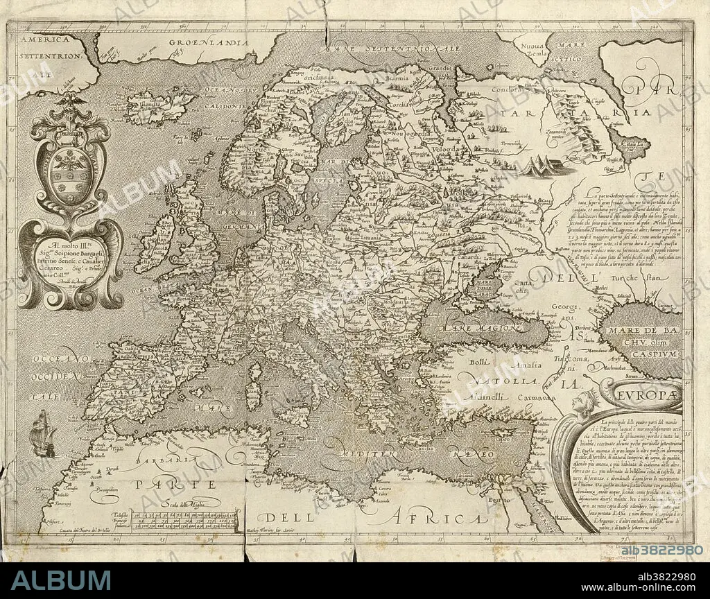
Map of Europe, 1600
Descripción:
Traducción automática: Mapa de Europa del siglo XVI. Publicado en Siena en 1600, este mapa italiano muestra los últimos conocimientos de la geografía de Europa. La escritura está en italiano y en la parte superior izquierda hay una dedicatoria en un cartucho, junto con el nombre del cartógrafo, Arnoldo di Arnoldi (fallecido en 1602). Las notas se encuentran en el extremo derecho y el título en la parte inferior derecha. Una barra de escala está en la parte inferior izquierda.
16th century map of Europe. Published in Sienna in 1600, this Italian map shows the latest knowledge of the geography of Europe. The writing is in Italian, and a dedication is given at upper left in a cartouche, along with the name of the cartographer, Arnoldo di Arnoldi (died 1602). Notes are given at far right, with the title at lower right. A scale bar is at lower left.
Crédito:
Album / Science Source / LOC/Geography and Map Division
Autorizaciones:
Modelo: No - Propiedad: No
¿Preguntas relacionadas con los derechos?
¿Preguntas relacionadas con los derechos?
Tamaño imagen:
5998 x 4753 px | 81.6 MB
Tamaño impresión:
50.8 x 40.2 cm | 20.0 x 15.8 in (300 dpi)
Palabras clave:
CARTOGRAFIA • EDAD MEDIA • EUROPA • EUROPEA • EUROPEAS • EUROPEO • EUROPEOS • EXPLORACION • GEOGRAFIA • GEOGRAFICO • HISTORIA • HISTORICO • HORIZONTAL • ITALIANO • MAPA • MEDIEVAL • S. XVI • SIGLO XVI • SIGLO XVII
