alb9661383
Map of India, 1857. Creator: Unknown.
| Compartir |
|---|
 Pinterest Pinterest |
 Twitter Twitter |
 Facebook Facebook |
 Copiar enlace Copiar enlace |
 Email Email |
|
Añadir a otro lightbox |
|
Añadir a otro lightbox |


¿Ya tienes cuenta? Iniciar sesión
¿No tienes cuenta? Regístrate
Compra esta imagen

Título:
Map of India, 1857. Creator: Unknown.
Descripción:
Ver traducción automática
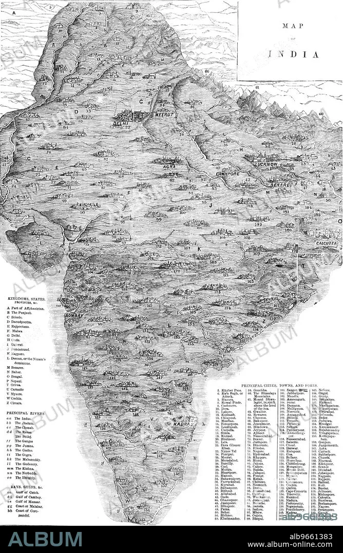
Map of India, 1857. Map of the Indian subcontinent during the British colonial period, showing 'Kingdoms, States, Provinces &c...Principal Rivers...Bays, Gulfs &c...Principal Cities, Towns, and Forts'. From "Illustrated London News", 1857.
Personas:
Crédito:
Album / The Print Collector/Heritage Images
Autorizaciones:
Modelo: No - Propiedad: No
¿Preguntas relacionadas con los derechos?
¿Preguntas relacionadas con los derechos?
Tamaño imagen:
3755 x 5758 px | 61.9 MB
Tamaño impresión:
31.8 x 48.8 cm | 12.5 x 19.2 in (300 dpi)
Palabras clave:
AFGANISTAN • AGRA • ASIA • BENARES • BLANCO Y NEGRO • BRITANICO • CALCUTA • CHENNAI • COLONIAL • COLONIALISMO • COLOR • CONTINENTE • COSTA • DELHI • GEOGRAFIA • GRABADO SOBRE MADERA • GRABADO • GRAN BRETAÑA • ILLUSTRATED LONDON NEWS • IMPERIALISMO • IMPERIO BRITANICO • IMPERIO • INDIA BRITANICA • INDIA • LITORAL • MADRAS • MAPA • PERIODICO • PRENSA • SIGLO XIX • SIGLO • TAMIL NADU • VARANASI
