alb5406767
Territorial Acquisitions of United States, Map
| Compartir |
|---|
 Pinterest Pinterest |
 Twitter Twitter |
 Facebook Facebook |
 Copiar enlace Copiar enlace |
 Email Email |
|
Añadir a otro lightbox |
|
Añadir a otro lightbox |


¿Ya tienes cuenta? Iniciar sesión
¿No tienes cuenta? Regístrate
Compra esta imagen

Título:
Territorial Acquisitions of United States, Map
Descripción:
Ver traducción automática
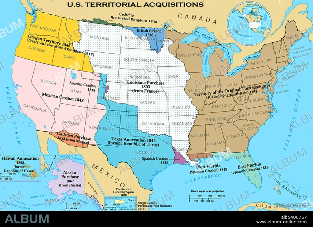
Territorial acquisitions of the United States, such as the Thirteen Colonies, the Louisiana Purchase, and the British and Spanish Cession.
Crédito:
Album / Science Source
Autorizaciones:
Modelo: No - Propiedad: No
¿Preguntas relacionadas con los derechos?
¿Preguntas relacionadas con los derechos?
Tamaño imagen:
2520 x 1703 px | 12.3 MB
Tamaño impresión:
21.3 x 14.4 cm | 8.4 x 5.7 in (300 dpi)
Palabras clave:
AMERICA • COMPRA DE LOUISIANA • DIVISION • ESTADOS UNIDOS DE AMERICA • GEOGRAFIA • HISTORIA • IMPRESION • MAPA • REGION • SECCIONES • SIGLO XIX • TIERRA (TERRENO)
