alb9203080
World Map with Prime Meridian
| Compartir |
|---|
 Pinterest Pinterest |
 Twitter Twitter |
 Facebook Facebook |
 Copiar enlace Copiar enlace |
 Email Email |
|
Añadir a otro lightbox |
|
Añadir a otro lightbox |


¿Ya tienes cuenta? Iniciar sesión
¿No tienes cuenta? Regístrate
Compra esta imagen.
Selecciona el uso:

Título: World Map with Prime Meridian
Descripción: Ver traducción automática
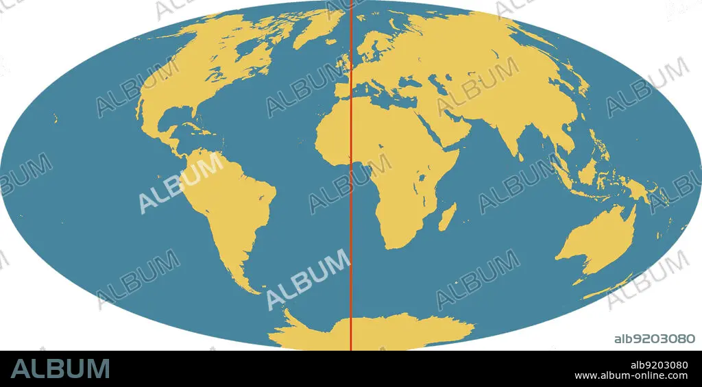
Outline of world map, showing the continents, oceans and prime meridian (in red). The prime meridian (also known as the Greenwich meridian) exactly marks the position of 0 degrees longitude. It is from this that the longitude of all points on the surface of the Earth are measured. This was agreed by an international convention in 1884. The meridian passes through the original site of the Greenwich observatory.
Outline of world map, showing the continents, oceans and prime meridian (in red). The prime meridian (also known as the Greenwich meridian) exactly marks the position of 0 degrees longitude. It is from this that the longitude of all points on the surface of the Earth are measured. This was agreed by an international convention in 1884. The meridian passes through the original site of the Greenwich observatory.
Crédito: Album / Science Source / Jessica Wilson/NASA
Autorizaciones: ? Cesión de modelo: No - ? Cesión de propiedad: No
¿Preguntas relacionadas con los derechos?
¿Preguntas relacionadas con los derechos?
Tamaño imagen: 4500 × 2249 px | 29.0 MB
Tamaño impresión: 38.1 × 19.0 cm | 1771.7 × 885.4 in (300 dpi)
