alb4539003
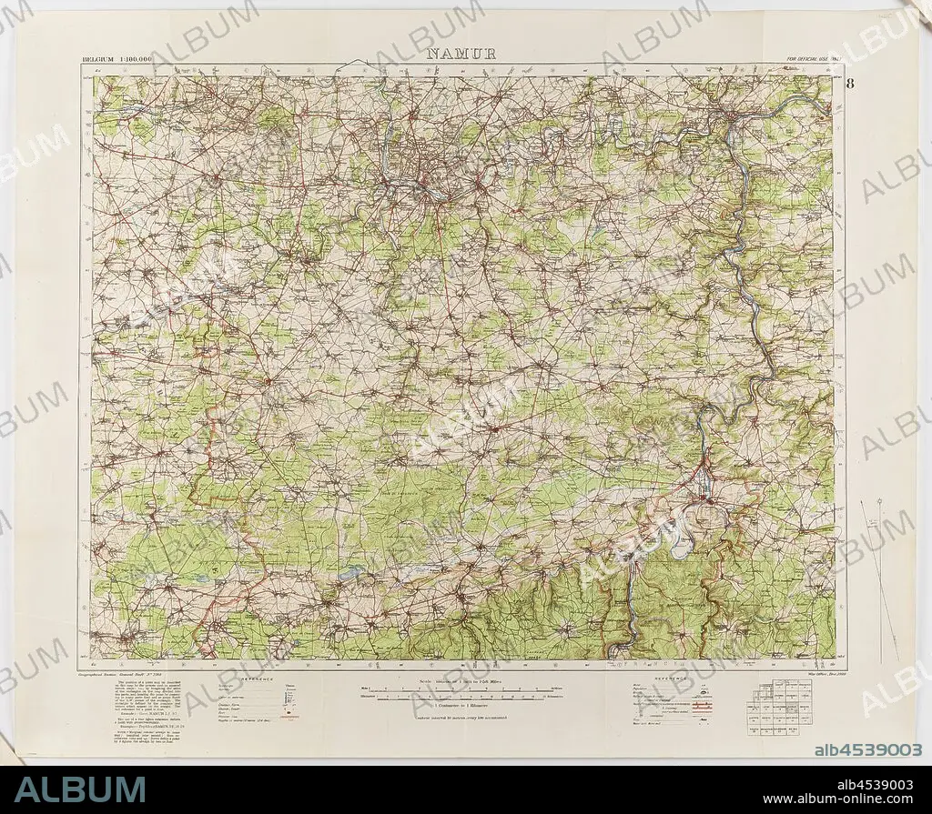
Map - Military, Belgium, Namur 8, General Staff no. 2364, Scale 1:100,000, World War I, 1910, Military map of Belgium, Namur area (a hand-written inscription identifies it as Namur 8 district), scale 1:100,000, published in 1910. The map is labelled General Staff No. 2364. It would have been used during World War I. Maps of this scale lacked the detail needed for trench warfare, instead providing an overview of regions for the use of senior commanders. Part of the collection of World.
| Compartir |
|---|
 Pinterest Pinterest |
 Twitter Twitter |
 Facebook Facebook |
 Copiar enlace Copiar enlace |
 Email Email |
|
Añadir a otro lightbox |
|
Añadir a otro lightbox |


¿Ya tienes cuenta? Iniciar sesión
¿No tienes cuenta? Regístrate
Compra esta imagen.
Selecciona el uso:

Descripción: Ver traducción automática
Map - Military, Belgium, Namur 8, General Staff no. 2364, Scale 1:100,000, World War I, 1910, Military map of Belgium, Namur area (a hand-written inscription identifies it as Namur 8 district), scale 1:100,000, published in 1910. The map is labelled General Staff No. 2364. It would have been used during World War I. Maps of this scale lacked the detail needed for trench warfare, instead providing an overview of regions for the use of senior commanders. Part of the collection of World
Map - Military, Belgium, Namur 8, General Staff no. 2364, Scale 1:100,000, World War I, 1910, Military map of Belgium, Namur area (a hand-written inscription identifies it as Namur 8 district), scale 1:100,000, published in 1910. The map is labelled General Staff No. 2364. It would have been used during World War I. Maps of this scale lacked the detail needed for trench warfare, instead providing an overview of regions for the use of senior commanders. Part of the collection of World
Crédito: Album / quintlox
Autorizaciones: ? Cesión de modelo: No - ? Cesión de propiedad: No
¿Preguntas relacionadas con los derechos?
¿Preguntas relacionadas con los derechos?
Tamaño imagen: 3900 × 3207 px | 35.8 MB
Tamaño impresión: 33.0 × 27.2 cm | 1535.4 × 1262.6 in (300 dpi)
Palabras clave: 100 • 1910 • 1ª GUERRA MUNDIAL • BELGICA • COLECCION • GUERRA MUNDIAL I 1914/18 • GUERRA MUNDIAL I • MAPA • MAPAS • MILITARES • MUNDO • PRIMERA GUERRA MUNDIAL 1914/18 • PRIMERA GUERRA MUNDIAL • PROPORCIONANDO • PUBLICA • REGIONES • VISIÓN GENERAL
