alb4068721
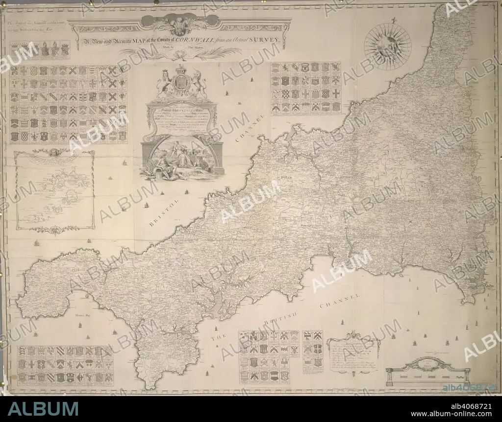
A map of the County of Cornwall. A new and accurate Map of the County of Cornwall, from an actual Survey made by Thos. Martyn, etc. (The Islands of Scilly). Feb., 1748/1749. Source: Maps K.Top.9.28.(1.). Language: English.
| Compartir |
|---|
 Pinterest Pinterest |
 Twitter Twitter |
 Facebook Facebook |
 Copiar enlace Copiar enlace |
 Email Email |
|
Añadir a otro lightbox |
|
Añadir a otro lightbox |


¿Ya tienes cuenta? Iniciar sesión
¿No tienes cuenta? Regístrate
Compra esta imagen

Descripción:
Ver traducción automática
A map of the County of Cornwall. A new and accurate Map of the County of Cornwall, from an actual Survey made by Thos. Martyn, etc. (The Islands of Scilly). Feb., 1748/1749. Source: Maps K.Top.9.28.(1.). Language: English.
Crédito:
Album / British Library
Autorizaciones:
Modelo: No - Propiedad: No
¿Preguntas relacionadas con los derechos?
¿Preguntas relacionadas con los derechos?
Tamaño imagen:
4875 x 3852 px | 53.7 MB
Tamaño impresión:
41.3 x 32.6 cm | 16.2 x 12.8 in (300 dpi)
Palabras clave:
CARTOGRAFIA • CARTOGRAFICO • ESCUDO DE ARMAS • GRAN BRETAÑA • HERALDICA • HERÁLDICO • INGLATERRA • MAPA • SIGLO XVIII
