alb1647120
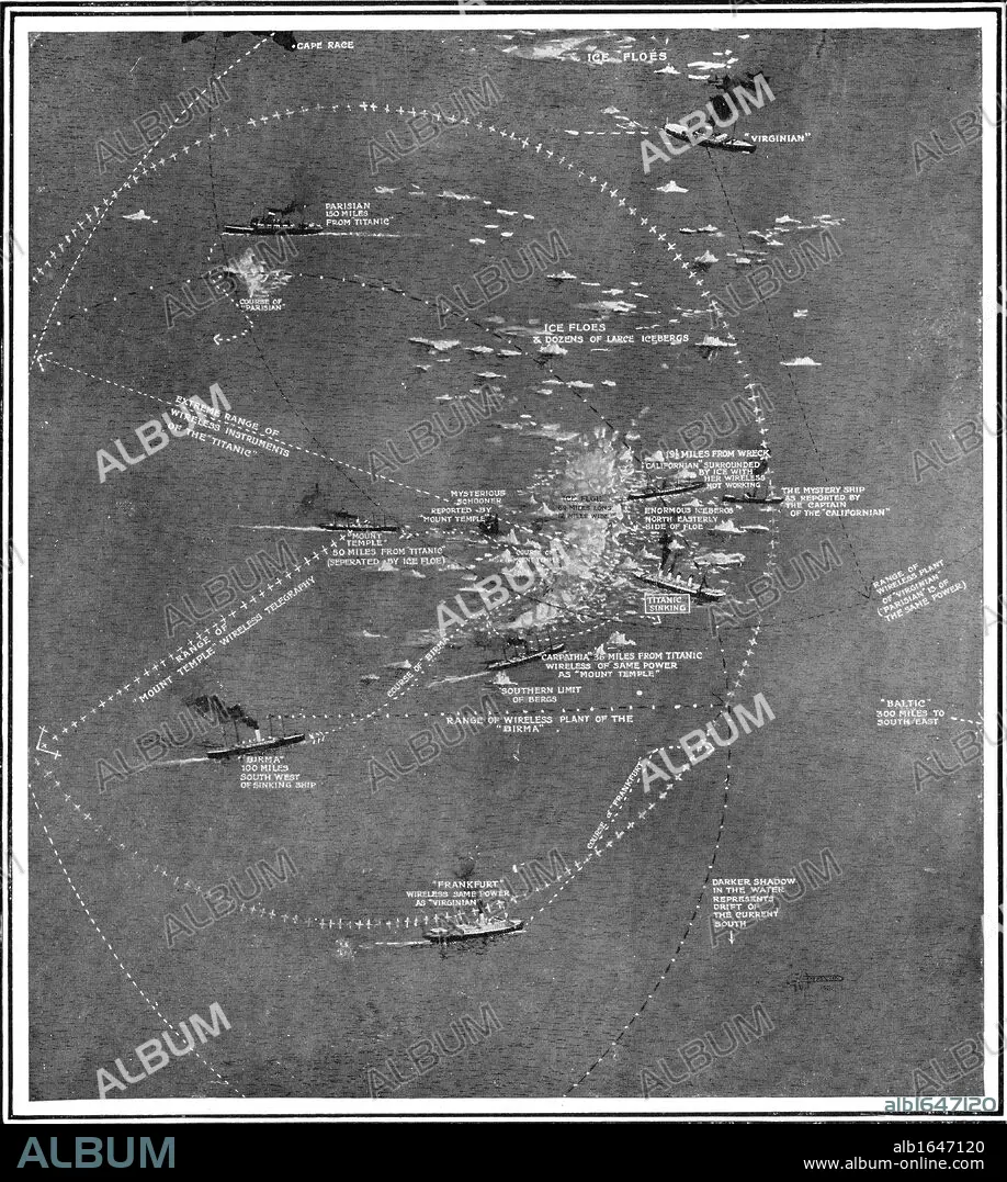
Chart of the RMS Titanic wreck site showing ships within call by wireless at the time of the collision.
| Compartir |
|---|
 Pinterest Pinterest |
 Twitter Twitter |
 Facebook Facebook |
 Copiar enlace Copiar enlace |
 Email Email |
|
Añadir a otro lightbox |
|
Añadir a otro lightbox |


¿Ya tienes cuenta? Iniciar sesión
¿No tienes cuenta? Regístrate
Compra esta imagen

Descripción:
Ver traducción automática
Chart of the RMS Titanic wreck site showing ships within call by wireless at the time of the collision
Crédito:
Album / Universal Images Group / Universal History Archive
Autorizaciones:
Modelo: No - Propiedad: No
¿Preguntas relacionadas con los derechos?
¿Preguntas relacionadas con los derechos?
Tamaño imagen:
4129 x 4606 px | 54.4 MB
Tamaño impresión:
35.0 x 39.0 cm | 13.8 x 15.4 in (300 dpi)
