alb9839453
ANON. Map of Noord-Holland and part of Friesland, 1726-1750. Creator: Anon.
| Compartir |
|---|
 Pinterest Pinterest |
 Twitter Twitter |
 Facebook Facebook |
 Copiar enlace Copiar enlace |
 Email Email |
|
Añadir a otro lightbox |
|
Añadir a otro lightbox |


¿Ya tienes cuenta? Iniciar sesión
¿No tienes cuenta? Regístrate
Compra esta imagen

Autor:
Título:
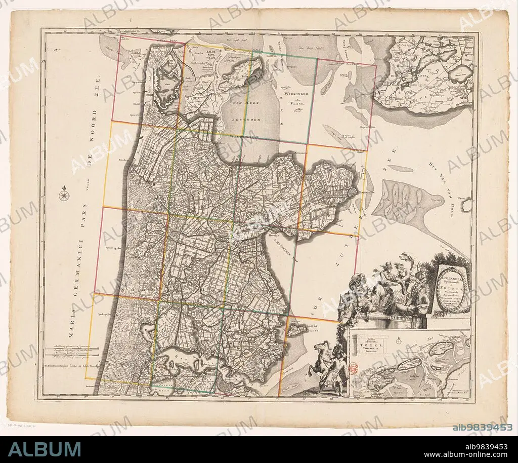
Map of Noord-Holland and part of Friesland, 1726-1750. Creator: Anon.
Descripción:
Ver traducción automática
Map of Noord-Holland and part of Friesland, 1726-1750. At the bottom right the title cartouche with figures around it including a man with a horse, satyrs, putti, Mercury who takes the horn of plenty from a female figure, and a river god. Below that a deployment map of the Wadden area with scale.
Crédito:
Album / Heritage Art/Heritage Images
Autorizaciones:
Modelo: No - Propiedad: No
¿Preguntas relacionadas con los derechos?
¿Preguntas relacionadas con los derechos?
Tamaño imagen:
5914 x 4972 px | 84.1 MB
Tamaño impresión:
50.1 x 42.1 cm | 19.7 x 16.6 in (300 dpi)
Palabras clave:
ACUARELA • ANGELICAL • ANIMAL • ANON • ANONIMA • ANONIMO • ARTE • ARTEFACTO • ARTES • BESTIA MITICA • BLANCO Y NEGRO • CABALLO • CABALLOS • CARTOGRAFIA • CHICO • COLOR • CONCEPTO • CORNUCOPIA • CRIATURA MÍTICA • CUERNO DE LA ABUNDANCIA • CULTURA • DEIDAD • DIBUJO • DIOS • ESCALA • ESCENA • EUROPA • EXHIBICION • EXPOSICION • FIGURA • GALERIA DE ARTE • GALERIA • GENTE • GRABADO • HISTORIA • HISTORICO • HOLANDES • HOMBRE • HOMBRES • ILUSTRACION • ILUSTRADO • IMPRESION • LAPIZ • LETRAS • MAPA • MASCULINO • MEDIDA • MITOLOGIA • MITOLOGICA • MITOLÓGICO • MUJER • MUJERES • MUSEO • PAISES BAJOS • PAPEL • PINACOTECA • PUTTI • PUTTO • QUERUBIN • QUERUBINES • RELIGION • RELIGIOSO • RETRATO DE HOMBRE • RIJKSMUSEUM • SATIROS • SATYRS • SIGLO XVIII • SIGLO • TEXTO
