alb5400643
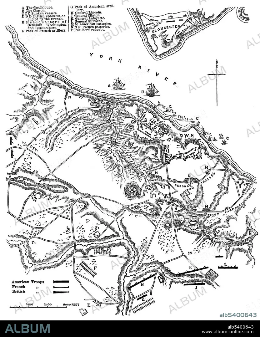
Historical drawing, US-American history, 18th century, map of the Battle of Yorktown, 1781, York County, Virginia, USA, North America.
| Compartir |
|---|
 Pinterest Pinterest |
 Twitter Twitter |
 Facebook Facebook |
 Copiar enlace Copiar enlace |
 Email Email |
|
Añadir a otro lightbox |
|
Añadir a otro lightbox |


¿Ya tienes cuenta? Iniciar sesión
¿No tienes cuenta? Regístrate
Compra esta imagen.
Selecciona el uso:

Descripción: Ver traducción automática
Historical drawing, US-American history, 18th century, map of the Battle of Yorktown, 1781, York County, Virginia, USA, North America
Historical drawing, US-American history, 18th century, map of the Battle of Yorktown, 1781, York County, Virginia, USA, North America
Crédito: Album / ImageBroker / H.-D. Falkenstein
Autorizaciones: ? Cesión de modelo: No - ? Cesión de propiedad: No
¿Preguntas relacionadas con los derechos?
¿Preguntas relacionadas con los derechos?
Tamaño imagen: 3771 × 4638 px | 50.0 MB
Tamaño impresión: 31.9 × 39.3 cm | 1484.6 × 1826.0 in (300 dpi)
Palabras clave: AMÉRICA DEL NORTE • AMERICA SEPTENTRIONAL • BATALLA • BATALLAS • BLANCO Y NEGRO • BOCETO • CARTAS • CONFLICTO BELICO • DIBUJO • DIBUJOS • EDAD • EE. UU • EE. UU. • EEUU / ESTADOS UNIDOS • EEUU • ESTADOS UNIDOS DE AMERICA • ESTADOS UNIDOS • GUERRA • GUERRAS • HISTORIA • HISTORICO • LETRAS • MAPA • NORTEAMERICA • PLANES • PLANIFICACIÓN • REPRESENTACIONES • S. XVIII • SIGLO XVIII • TARJETA • TARJETAS • U. S. A. • USA • VIRGINIA • VISIÓN GENERAL • VISTAS GENERALES • WAR • YORK
