alb4090241
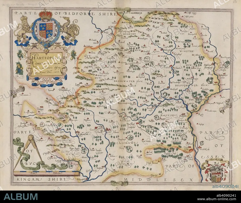
CHRISTOPHER SAXTON. Hertfordshire. Atlas of the Counties of England and Wales. London, 1579. Map of Hertfordshire. Image taken from Atlas of the Counties of England and Wales. Originally published/produced in 1579. Source: Maps.C.3.bb.5, 13.
| Compartir |
|---|
 Pinterest Pinterest |
 Twitter Twitter |
 Facebook Facebook |
 Copiar enlace Copiar enlace |
 Email Email |
|
Añadir a otro lightbox |
|
Añadir a otro lightbox |


¿Ya tienes cuenta? Iniciar sesión
¿No tienes cuenta? Regístrate
Compra esta imagen

Descripción:
Ver traducción automática
Hertfordshire. Atlas of the Counties of England and Wales. London, 1579. Map of Hertfordshire. Image taken from Atlas of the Counties of England and Wales. Originally published/produced in 1579. Source: Maps.C.3.bb.5, 13.
Crédito:
Album / British Library
Autorizaciones:
Modelo: No - Propiedad: No
¿Preguntas relacionadas con los derechos?
¿Preguntas relacionadas con los derechos?
Tamaño imagen:
10000 x 7913 px | 226.4 MB
Tamaño impresión:
84.7 x 67.0 cm | 33.3 x 26.4 in (300 dpi)
Palabras clave:
