alb3924201
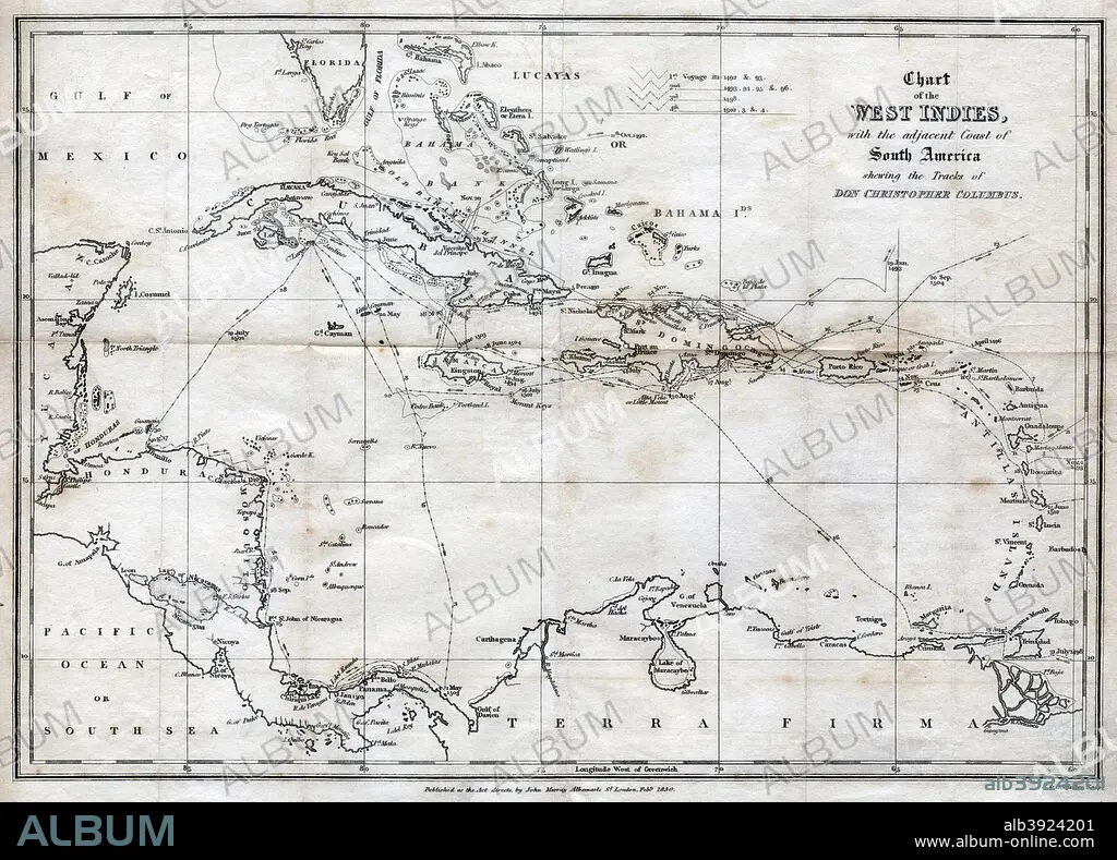
Chart of the West Indies, with the adjacent Coast of South America, 1830. Artist: J&C Walker
| Compartir |
|---|
 Pinterest Pinterest |
 Twitter Twitter |
 Facebook Facebook |
 Copiar enlace Copiar enlace |
 Email Email |
|
Añadir a otro lightbox |
|
Añadir a otro lightbox |


¿Ya tienes cuenta? Iniciar sesión
¿No tienes cuenta? Regístrate
Compra esta imagen.
Selecciona el uso:

Título:
Chart of the West Indies, with the adjacent Coast of South America, 1830. Artist: J&C Walker
Descripción:
Ver traducción automática
Chart of the West Indies, with the adjacent Coast of South America, 1830. Map of the Caribbean, showing the tracks of Christopher Columbus.
Crédito:
Album / The Print Collector / Heritage Images
Autorizaciones:
Tamaño imagen:
4940 x 3549 px | 50.2 MB
Tamaño impresión:
41.8 x 30.0 cm | 16.5 x 11.8 in (300 dpi)
Palabras clave:
BLANCO Y NEGRO • CARIBE • CARTOGRAFIA • CONCEPTO • CONTINENTE • COSTA • DESCUBRIDOR • DESCUBRIMIENTO • ESPANA • ESPANOL • ESPAÑA • EXPLORACION • EXPLORADOR • GEOGRAFIA • GRABADO • INDIAS OCCIDENTALES • ISLA • ITALIA • ITALIANO • MAPA • MAR • MONOCHROME • MONOCROMO • PAÍS • S. -XV • S. XV • S. XVI • SIGLO XIX • SIGLO XV • SIGLO XVI • SIGLO • SUDAMERICA • TRAVESIA • TRAYECTO • VIAJAR • VIAJE • VIAJES
