alb1654425
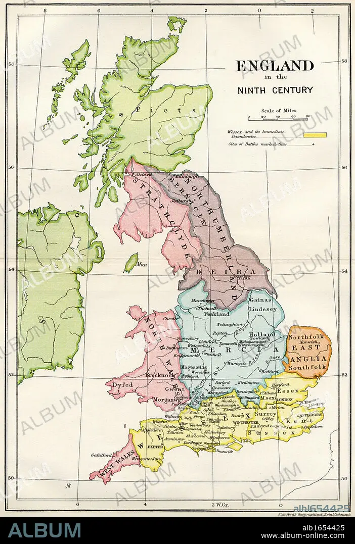
Map of England in the Ninth Century from A Short History of the English People by John Richard Green published by Macmillan and Co 1911.
| Compartir |
|---|
 Pinterest Pinterest |
 Twitter Twitter |
 Facebook Facebook |
 Copiar enlace Copiar enlace |
 Email Email |
|
Añadir a otro lightbox |
|
Añadir a otro lightbox |


¿Ya tienes cuenta? Iniciar sesión
¿No tienes cuenta? Regístrate
Compra esta imagen.
Selecciona el uso:

Descripción:
Ver traducción automática
Map of England in the Ninth Century from A Short History of the English People by John Richard Green published by Macmillan and Co 1911
Crédito:
Album / Universal History Archive/Universal Images Group
Autorizaciones:
Tamaño imagen:
3661 x 5337 px | 55.9 MB
Tamaño impresión:
31.0 x 45.2 cm | 12.2 x 17.8 in (300 dpi)
Palabras clave:
BRITANICO • BRITANICOS • CARTOGRAFIA • COLOR • COLORIDO • GENTE • GRAN BRETAÑA • HISTORIA • INGLATERRA • INGLES • INGLESA • INGLESES • KEN • MAPA • NOVENA • PEOPLE • PERSONAS • REINO UNIDO • S. IX • SIGLO IX • SIGLO • VERTICAL
