alb4205523
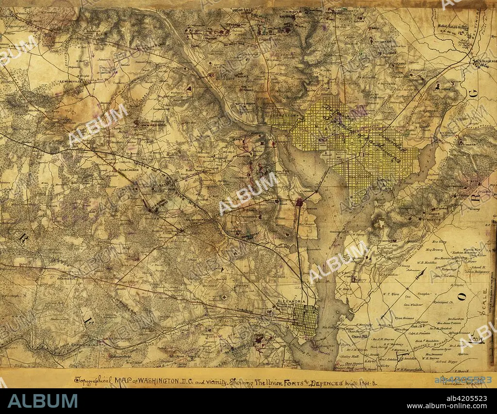
Washington, D. C., Showing the Union forts and defenses
| Compartir |
|---|
 Pinterest Pinterest |
 Twitter Twitter |
 Facebook Facebook |
 Copiar enlace Copiar enlace |
 Email Email |
|
Añadir a otro lightbox |
|
Añadir a otro lightbox |


¿Ya tienes cuenta? Iniciar sesión
¿No tienes cuenta? Regístrate
Compra esta imagen.
Selecciona el uso:

Título:
Washington, D. C., Showing the Union forts and defenses
Descripción:
Ver traducción automática
Topographical map of Washington, D.C., and vicinity. Showing the Union forts and defenses built 1861-3.. Topographical map of Washington, D.C., and vicinity. Showing the Union forts and defenses built 1861-3. Issued by Topographical Bureau, War Department, Col. Woodruff. - Col. Woodruff
Crédito:
Album / Universal Images Group / Universal History Archive/UIG
Autorizaciones:
Modelo: No - Propiedad: No
¿Preguntas relacionadas con los derechos?
¿Preguntas relacionadas con los derechos?
Tamaño imagen:
5242 x 4094 px | 61.4 MB
Tamaño impresión:
44.4 x 34.7 cm | 17.5 x 13.6 in (300 dpi)
Palabras clave:
AGRESION • BATALLA • CARTOGRAFIA • CASTROS • CIVIL • CONFLICTO BELICO • DC • EE. UU • EE. UU. • EEUU • ENTRÉ • ESTADOS UNIDOS DE AMERICA • ESTADOS UNIDOS USA EUA EEUU • ESTADOS UNIDOS • FÉDÉRAL • FORTIFICACIONES • GUERRA • LUCHA • MAPA • REBELDES • REBELION • U. S. A. • USA • WAR
