alb4094495
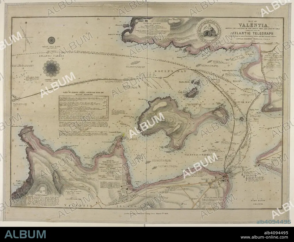
FREDERIC BRINE. Map showing a coast of Valentia island and the harbour; Doulus bay; and the lines of cables connected with the Atlantic telegraph. Map of Valentia shewing the positions of the various Ships and Lines of Cable connected with the Atlantic Telegraph. Compiled ... by Captain F. Brine. London : E. Stanford, 1859. Source: Maps.12094.(1).
| Compartir |
|---|
 Pinterest Pinterest |
 Twitter Twitter |
 Facebook Facebook |
 Copiar enlace Copiar enlace |
 Email Email |
|
Añadir a otro lightbox |
|
Añadir a otro lightbox |


¿Ya tienes cuenta? Iniciar sesión
¿No tienes cuenta? Regístrate
Compra esta imagen.
Selecciona el uso:

Autor:
Descripción:
Ver traducción automática
Map showing a coast of Valentia island and the harbour; Doulus bay; and the lines of cables connected with the Atlantic telegraph. Map of Valentia shewing the positions of the various Ships and Lines of Cable connected with the Atlantic Telegraph. Compiled ... by Captain F. Brine. London : E. Stanford, 1859. Source: Maps.12094.(1).
Crédito:
Album / British Library
Autorizaciones:
Modelo: No - Propiedad: No
¿Preguntas relacionadas con los derechos?
¿Preguntas relacionadas con los derechos?
Tamaño imagen:
5760 x 4456 px | 73.4 MB
Tamaño impresión:
48.8 x 37.7 cm | 19.2 x 14.9 in (300 dpi)
Palabras clave:
ATLANTICO • BRINE, FREDERIC • CARTOGRAFIA • CARTOGRAFICO • COLOR • COLORES • COLORIDO • EUROPA OCCIDENTAL • EUROPA • IRLANDA • ISLAS BRITANICAS • MAPA • OCEANO ATLANTICO • S. XIX • SIGLO XIX • TELEGRAFO
