alb1963759
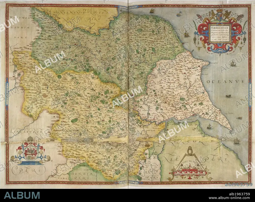
Map of Yorkshire. EBORACENSIS Comitatus. MAPS OF COUNTIES of England and Wales, printed and coloured; from drawings by Christopher Saxton. 1577. Source: Royal 18 D. III, ff.60v-61.
| Compartir |
|---|
 Pinterest Pinterest |
 Twitter Twitter |
 Facebook Facebook |
 Copiar enlace Copiar enlace |
 Email Email |
|
Añadir a otro lightbox |
|
Añadir a otro lightbox |


¿Ya tienes cuenta? Iniciar sesión
¿No tienes cuenta? Regístrate
Compra esta imagen.
Selecciona el uso:

Descripción:
Ver traducción automática
Map of Yorkshire. EBORACENSIS Comitatus. MAPS OF COUNTIES of England and Wales, printed and coloured; from drawings by Christopher Saxton. 1577. Source: Royal 18 D. III, ff.60v-61.
Crédito:
Album / British Library
Autorizaciones:
Modelo: No - Propiedad: No
¿Preguntas relacionadas con los derechos?
¿Preguntas relacionadas con los derechos?
Tamaño imagen:
6011 x 4469 px | 76.9 MB
Tamaño impresión:
50.9 x 37.8 cm | 20.0 x 14.9 in (300 dpi)
Palabras clave:
