alb4460817
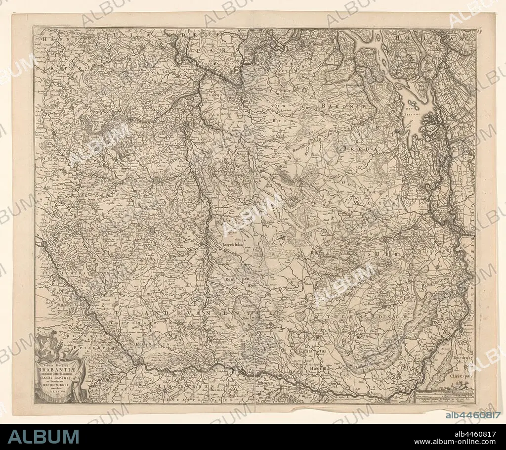
Map of the Duchy of Brabant, Tabula ducatus Brabantiae continens marchionatum sacri imperii and dominium Mechliniense (title on object), Map of Brabant. The north top right, compass rose in the middle. Bottom left cartouche with title, coat of arms, weapons, draperies and putto. Bottom right scale in German miles and Urengaans 'controlling 3 German Miles', maps of separate countries or regions, Brabant, Frederik de Wit, Amsterdam, 1666, paper, engraving, h 49.5 cm × w 54.7 cm.
| Compartir |
|---|
 Pinterest Pinterest |
 Twitter Twitter |
 Facebook Facebook |
 Copiar enlace Copiar enlace |
 Email Email |
|
Añadir a otro lightbox |
|
Añadir a otro lightbox |


¿Ya tienes cuenta? Iniciar sesión
¿No tienes cuenta? Regístrate
Compra esta imagen.
Selecciona el uso:

Descripción: Ver traducción automática
Map of the Duchy of Brabant, Tabula ducatus Brabantiae continens marchionatum sacri imperii and dominium Mechliniense (title on object), Map of Brabant. The north top right, compass rose in the middle. Bottom left cartouche with title, coat of arms, weapons, draperies and putto. Bottom right scale in German miles and Urengaans 'controlling 3 German Miles', maps of separate countries or regions, Brabant, Frederik de Wit, Amsterdam, 1666, paper, engraving, h 49.5 cm × w 54.7 cm
Map of the Duchy of Brabant, Tabula ducatus Brabantiae continens marchionatum sacri imperii and dominium Mechliniense (title on object), Map of Brabant. The north top right, compass rose in the middle. Bottom left cartouche with title, coat of arms, weapons, draperies and putto. Bottom right scale in German miles and Urengaans 'controlling 3 German Miles', maps of separate countries or regions, Brabant, Frederik de Wit, Amsterdam, 1666, paper, engraving, h 49.5 cm × w 54.7 cm
Crédito: Album / quintlox
Autorizaciones: ? Cesión de modelo: No - ? Cesión de propiedad: No
¿Preguntas relacionadas con los derechos?
¿Preguntas relacionadas con los derechos?
Tamaño imagen: 5860 × 4903 px | 82.2 MB
Tamaño impresión: 49.6 × 41.5 cm | 2307.1 × 1930.3 in (300 dpi)
