alb2203328
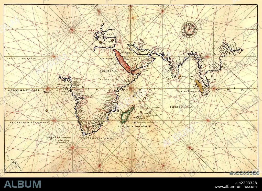
Portolan Map of Africa, the Indian Ocean and the Indian Subcontinent 1544
| Compartir |
|---|
 Pinterest Pinterest |
 Twitter Twitter |
 Facebook Facebook |
 Copiar enlace Copiar enlace |
 Email Email |
|
Añadir a otro lightbox |
|
Añadir a otro lightbox |


¿Ya tienes cuenta? Iniciar sesión
¿No tienes cuenta? Regístrate
Compra esta imagen

Título:
Portolan Map of Africa, the Indian Ocean and the Indian Subcontinent 1544
Descripción:
Ver traducción automática
Portolan Map of Africa, the Indian Ocean and the Indian Subcontinent. Done in 1544 by the Italian cartographer Battista Agnese.
Crédito:
Album / Universal Images Group / Universal History Archive/UIG
Autorizaciones:
Modelo: No - Propiedad: No
¿Preguntas relacionadas con los derechos?
¿Preguntas relacionadas con los derechos?
Tamaño imagen:
5083 x 3450 px | 50.2 MB
Tamaño impresión:
43.0 x 29.2 cm | 16.9 x 11.5 in (300 dpi)
