alb5371389
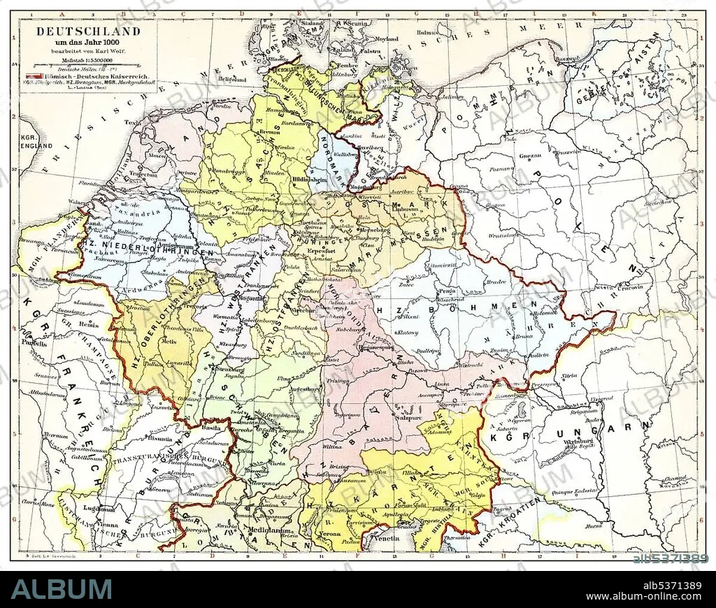
Historical map of Germany and Europe, Roman-German Empire in the 10th Century, from Meyers Konversations-Lexikon encyclopaedia, 1890
| Compartir |
|---|
 Pinterest Pinterest |
 Twitter Twitter |
 Facebook Facebook |
 Copiar enlace Copiar enlace |
 Email Email |
|
Añadir a otro lightbox |
|
Añadir a otro lightbox |


¿Ya tienes cuenta? Iniciar sesión
¿No tienes cuenta? Regístrate
Compra esta imagen.
Selecciona el uso:

Descripción: Ver traducción automática
Historical map of Germany and Europe, Roman-German Empire in the 10th Century, from Meyers Konversations-Lexikon encyclopaedia, 1890
Historical map of Germany and Europe, Roman-German Empire in the 10th Century, from Meyers Konversations-Lexikon encyclopaedia, 1890
Crédito: Album / ImageBroker / H.-D. Falkenstein
Autorizaciones: ? Cesión de modelo: No - ? Cesión de propiedad: No
¿Preguntas relacionadas con los derechos?
¿Preguntas relacionadas con los derechos?
Tamaño imagen: 4699 × 3746 px | 50.4 MB
Tamaño impresión: 39.8 × 31.7 cm | 1850.0 × 1474.8 in (300 dpi)
Palabras clave: ALEMAN • ALEMANA • ALEMANES • ALEMANIA • BOCETO • CARTAS • COLOREADA • COLOREADO • COLORIDO • CUADRO • CUADROS • DIBUJO • DIBUJOS • EDAD • EN COLOR • ENCICLOPEDIA • EUROPA • FIGURA • GEOGRAFIA • GEOGRAFICA • GEOGRAFICO • HISTORIA • HISTORICO • ILUSTRACION • ILUSTRACIONES • IMPERIO ALEMAN • LABOR • LIBRO DE REFERENCIA • LIBRO • LIBROS • MAPA • MULTICOLOR • PINTURA • PINTURAS • REPRESENTACIONES • REPUBLICA FEDERAL ALEMANA • ROMANO • ROMANOS • SIGLO • TARJETA • TARJETAS • TRABAJANDO • TRABAJO • VARIOS COLORES
