alb5470742
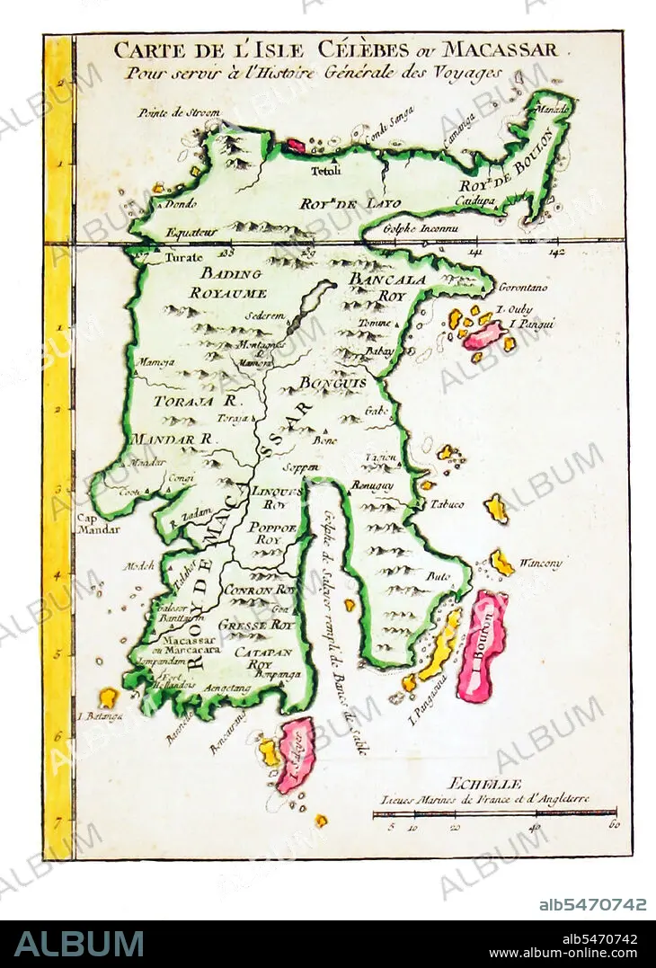
Early map of Sulawesi (the Celebes), J. N. Bellin, Amsterdam, c. 1760.
| Compartir |
|---|
 Pinterest Pinterest |
 Twitter Twitter |
 Facebook Facebook |
 Copiar enlace Copiar enlace |
 Email Email |
|
Añadir a otro lightbox |
|
Añadir a otro lightbox |


¿Ya tienes cuenta? Iniciar sesión
¿No tienes cuenta? Regístrate
Compra esta imagen.
Selecciona el uso:

Título: Early map of Sulawesi (the Celebes), J. N. Bellin, Amsterdam, c. 1760.
Descripción: Ver traducción automática
Sulawesi (formerly known as Celebes) is one of the four larger Sunda Islands of Indonesia and is situated between Borneo and the Maluku Islands. In Indonesia, only Sumatra, Borneo, and Papua are larger in territory, and only Java and Sumatra have larger Indonesian populations.
Sulawesi (formerly known as Celebes) is one of the four larger Sunda Islands of Indonesia and is situated between Borneo and the Maluku Islands. In Indonesia, only Sumatra, Borneo, and Papua are larger in territory, and only Java and Sumatra have larger Indonesian populations.
Crédito: Album / Pictures From History/Universal Images Group
Autorizaciones: ? Cesión de modelo: No - ? Cesión de propiedad: No
¿Preguntas relacionadas con los derechos?
¿Preguntas relacionadas con los derechos?
Tamaño imagen: 3500 × 4908 px | 49.1 MB
Tamaño impresión: 29.6 × 41.6 cm | 1378.0 × 1932.3 in (300 dpi)
Palabras clave: ART • ARTE • ARTES • ASIA • ASIATICO • CARTOGRAFIA • CARTOGRAFICO • DESCUBRIMIENTO • EXPLORACION • GRAFICO • HISTORICO • INDONESIA • INDONESIO • MAPA • MAPAS • SULAWESI
