alb5668872
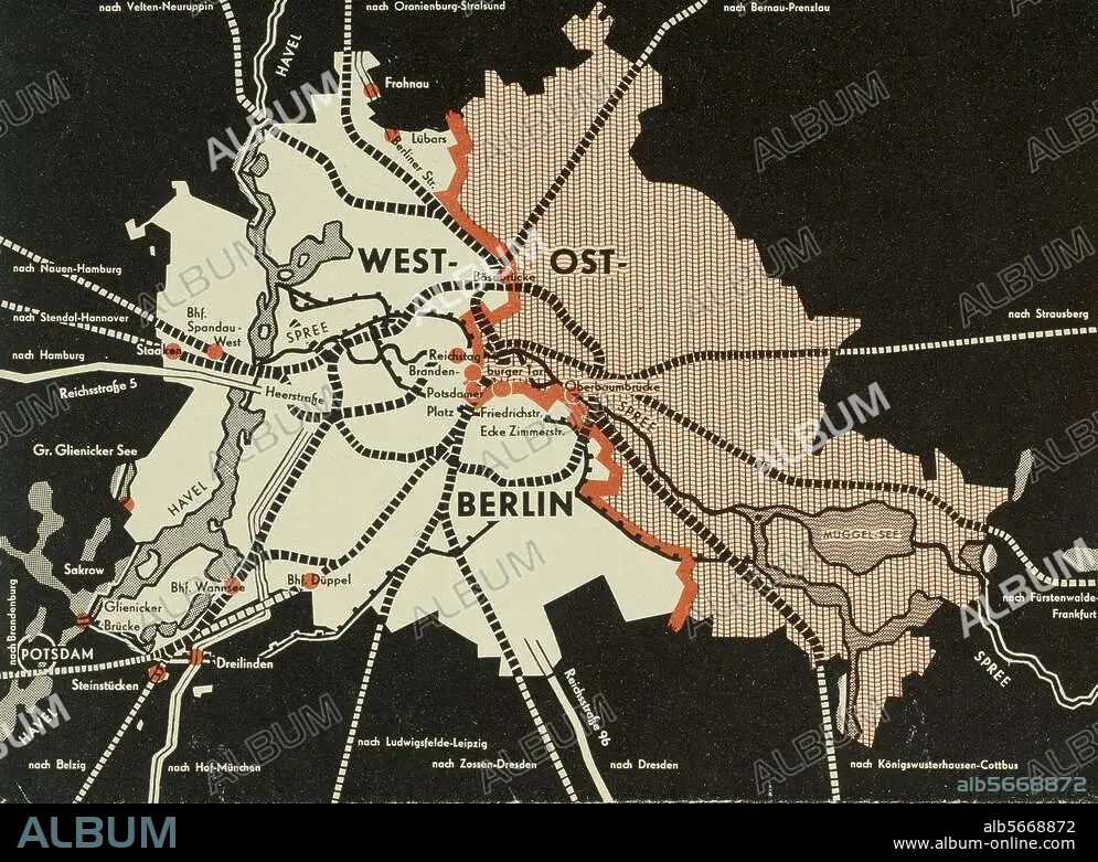
Free City Between Barbed Wire / Map of Berlin Showing Sector Boundaries / Pamphlet, 1959
| Compartir |
|---|
 Pinterest Pinterest |
 Twitter Twitter |
 Facebook Facebook |
 Copiar enlace Copiar enlace |
 Email Email |
|
Añadir a otro lightbox |
|
Añadir a otro lightbox |


¿Ya tienes cuenta? Iniciar sesión
¿No tienes cuenta? Regístrate
Compra esta imagen.
Selecciona el uso:

Título: Free City Between Barbed Wire / Map of Berlin Showing Sector Boundaries / Pamphlet, 1959
Descripción: Ver traducción automática
Berlin / Cold War. Map of East and West Berlin showing sector boundaries. The Eastern sector is empty (striped). Back of a West German government pamphlet on German issues with the title: "Free City between Barbed Wire", 1959.
Berlin / Cold War. Map of East and West Berlin showing sector boundaries. The Eastern sector is empty (striped). Back of a West German government pamphlet on German issues with the title: "Free City between Barbed Wire", 1959.
Técnica/material: ESTAMPADO
Localización: BERLIN
Crédito: Album / akg-images
Autorizaciones: ? Cesión de modelo: No - ? Cesión de propiedad: No
¿Preguntas relacionadas con los derechos?
¿Preguntas relacionadas con los derechos?
Tamaño imagen: 3364 × 2462 px | 23.7 MB
Tamaño impresión: 28.5 × 20.8 cm | 1324.4 × 969.3 in (300 dpi)
Palabras clave: ALEMANIA • AÑOS 50 • AÑOS CINCUENTA • BERLIN • ESTAMPADO • FRONTERA EN EL SECTOR • GUERRA FRIA • HISTORIA • MAPA • MAPAS • S. XX • SIGLO XX
