alb4061103
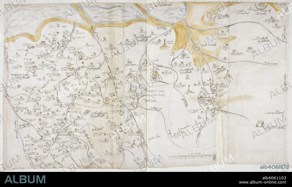
CHRISTOPHER SAXTON. A 16th century map of Lancashire, by Saxton. Lord Burghley's Atlas. London; 1579. Source: Royal 18 D. III, ff.81v-82. Language: English.
| Compartir |
|---|
 Pinterest Pinterest |
 Twitter Twitter |
 Facebook Facebook |
 Copiar enlace Copiar enlace |
 Email Email |
|
Añadir a otro lightbox |
|
Añadir a otro lightbox |


¿Ya tienes cuenta? Iniciar sesión
¿No tienes cuenta? Regístrate
Compra esta imagen

Descripción:
Ver traducción automática
A 16th century map of Lancashire, by Saxton. Lord Burghley's Atlas. London; 1579. Source: Royal 18 D. III, ff.81v-82. Language: English.
Crédito:
Album / British Library
Autorizaciones:
Modelo: No - Propiedad: No
¿Preguntas relacionadas con los derechos?
¿Preguntas relacionadas con los derechos?
Tamaño imagen:
6884 x 4053 px | 79.8 MB
Tamaño impresión:
58.3 x 34.3 cm | 22.9 x 13.5 in (300 dpi)
Palabras clave:
