alb5369348
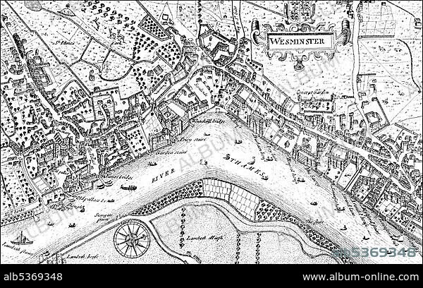
Historic drawing, city map of Westminster with the River Thames, 17th century, a district of London, England, Europe
| Compartir |
|---|
 Pinterest Pinterest |
 Twitter Twitter |
 Facebook Facebook |
 Copiar enlace Copiar enlace |
 Email Email |
|
Añadir a otro lightbox |
|
Añadir a otro lightbox |


¿Ya tienes cuenta? Iniciar sesión
¿No tienes cuenta? Regístrate
Compra esta imagen.
Selecciona el uso:

Descripción:
Ver traducción automática
Historic drawing, city map of Westminster with the River Thames, 17th century, a district of London, England, Europe
Crédito:
Album / ImageBroker / H.-D. Falkenstein
Autorizaciones:
Tamaño imagen:
5300 x 3309 px | 50.2 MB
Tamaño impresión:
44.9 x 28.0 cm | 17.7 x 11.0 in (300 dpi)
Palabras clave:
BLANCO Y NEGRO • BOCETO • BRITANICO • CIUDAD DE WESTMINSTER • CUADRO • CUADROS • DIBUJO • DIBUJOS • EDAD • EUROPA • EUROPEA • EUROPEAS • EUROPEO • EUROPEOS • GRAN BRETAÑA • HISTORIA • HISTORICO • INGLATERRA • INGLES • MAPA URBANO • PINTURA • PINTURAS • REINO UNIDO • REPRESENTACIONES • RIO TAMESIS • SIGLO XVII • TAMESIS • WESTMINSTER
