alb4093315
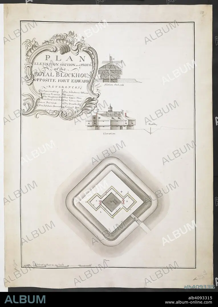
Plan elevation section and profile of the Royal Blockhouse opposite Fort Edward' by Thomas Sowers; 1759. . R.U.S.I. MAPS. Vol. LXXVI (1-13). 57711 (1-4). Places in states North-East of New York. 18th century. 1759. 1:240. 'Scale of 20 feet to an inch'. Scale bar of 120 feet (= 6 inches). 555 x 395mm. Source: Add. 57711. Amherst no. A 78. R.U.S.I. no. A 28.64.
| Compartir |
|---|
 Pinterest Pinterest |
 Twitter Twitter |
 Facebook Facebook |
 Copiar enlace Copiar enlace |
 Email Email |
|
Añadir a otro lightbox |
|
Añadir a otro lightbox |


¿Ya tienes cuenta? Iniciar sesión
¿No tienes cuenta? Regístrate
Compra esta imagen.
Selecciona el uso:

Descripción:
Ver traducción automática
Plan elevation section and profile of the Royal Blockhouse opposite Fort Edward' by Thomas Sowers; 1759. . R.U.S.I. MAPS. Vol. LXXVI (1-13). 57711 (1-4). Places in states North-East of New York. 18th century. 1759. 1:240. 'Scale of 20 feet to an inch'. Scale bar of 120 feet (= 6 inches). 555 x 395mm. Source: Add. 57711. Amherst no. A 78. R.U.S.I. no. A 28.64.
Personas:
Crédito:
Album / British Library
Autorizaciones:
Tamaño imagen:
6312 x 8448 px | 152.6 MB
Tamaño impresión:
53.4 x 71.5 cm | 21.0 x 28.2 in (300 dpi)
Palabras clave:
ACONTECIMIENTO • AMÉRICA DEL NORTE • AMERICA SEPTENTRIONAL • CASTROS • COMBATE • CONFLICTO ARMADO • CONFLICTO BELICO • CONFLICTOS ARMADOS • DOCUMENTO • EVENTO MILITAR • EVENTOS MILITARES • FORTALEZA • FUERTE (EDIFICIO) • GUERRA • MILITAR • NADIE • NORTEAMERICA • PLAN • S. XVIII • SIGLO XVIII • WAR
