alb9203469
Islamic World and Sea Trade, Map
| Compartir |
|---|
 Pinterest Pinterest |
 Twitter Twitter |
 Facebook Facebook |
 Copiar enlace Copiar enlace |
 Email Email |
|
Añadir a otro lightbox |
|
Añadir a otro lightbox |


¿Ya tienes cuenta? Iniciar sesión
¿No tienes cuenta? Regístrate
Compra esta imagen.
Selecciona el uso:

Título: Islamic World and Sea Trade, Map
Descripción: Ver traducción automática
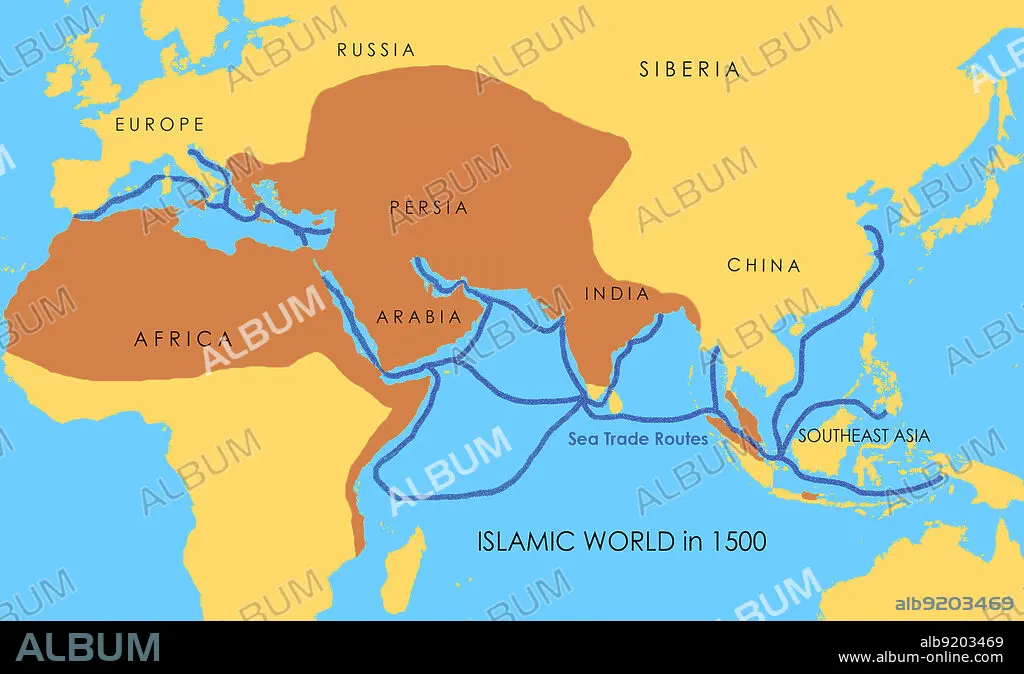
A map showing a network of medieval sea trade routes. The areas in darker yellow indicate the extent of the Islamic world in 1500.
A map showing a network of medieval sea trade routes. The areas in darker yellow indicate the extent of the Islamic world in 1500.
Crédito: Album / Jessica Wilson / Science Source
Autorizaciones: ? Cesión de modelo: No - ? Cesión de propiedad: No
¿Preguntas relacionadas con los derechos?
¿Preguntas relacionadas con los derechos?
Tamaño imagen: 2868 × 1740 px | 14.3 MB
Tamaño impresión: 24.3 × 14.7 cm | 1129.1 × 685.0 in (300 dpi)
Palabras clave: AFRICA • ASIA • CHINA • COMERCIO • EUROPA • INDIA • INFOGRAFÍA • ISLAM • ISLAMICAS • ISLÁMICO • ISLAMICOS • MAPA • MAR • MARITIMO • MEDIA • MEDIEVAL • MEDITERRANEO • MIDDLE • MITOLOGIA: PERSA • MUNDIAL • MUNDO • NÁUTICO • ORIENTE • PERSA • PERSAS • PERSIA • S. XVI • SIGLO XVI • SIGLO • SUDESTE • TACHADO • TIERRA (TERRENO) • ZONAS
