alb9235707
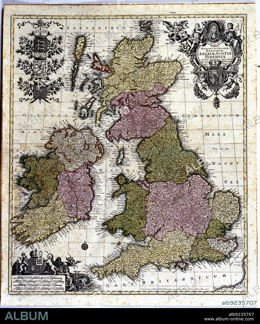
Coloured map of England, Ireland and Scotland, 1780. Creator: Seutter, Georg Matthew (1678-1757).
| Compartir |
|---|
 Pinterest Pinterest |
 Twitter Twitter |
 Facebook Facebook |
 Copiar enlace Copiar enlace |
 Email Email |
|
Añadir a otro lightbox |
|
Añadir a otro lightbox |


¿Ya tienes cuenta? Iniciar sesión
¿No tienes cuenta? Regístrate
Compra esta imagen.
Selecciona el uso:

Título:
Coloured map of England, Ireland and Scotland, 1780. Creator: Seutter, Georg Matthew (1678-1757).
Descripción:
Ver traducción automática
Coloured map of England, Ireland and Scotland. Edited in 1780.
Crédito:
Album / Arxiu Delstres - Index/Heritage Images
Autorizaciones:
Modelo: No - Propiedad: No
¿Preguntas relacionadas con los derechos?
¿Preguntas relacionadas con los derechos?
Tamaño imagen:
4797 x 5669 px | 77.8 MB
Tamaño impresión:
40.6 x 48.0 cm | 16.0 x 18.9 in (300 dpi)
Palabras clave:
1780 • ANIMAL • BRETAÑA • CABALLO CON ALAS • CABALLO VOLADOR • COLOR • COLORIDO • ESCOCIA • HECHO • INGLATERRA • IRLANDA • MADE • MAPA • PEGASO • S. XVIII • SIGLO XVIII • UNICORNIO
