alb3814404
Mississippi Flood, 1915
| Compartir |
|---|
 Pinterest Pinterest |
 Twitter Twitter |
 Facebook Facebook |
 Copiar enlace Copiar enlace |
 Email Email |
|
Añadir a otro lightbox |
|
Añadir a otro lightbox |


¿Ya tienes cuenta? Iniciar sesión
¿No tienes cuenta? Regístrate
Compra esta imagen.
Selecciona el uso:

Título: Mississippi Flood, 1915
Descripción: Ver traducción automática
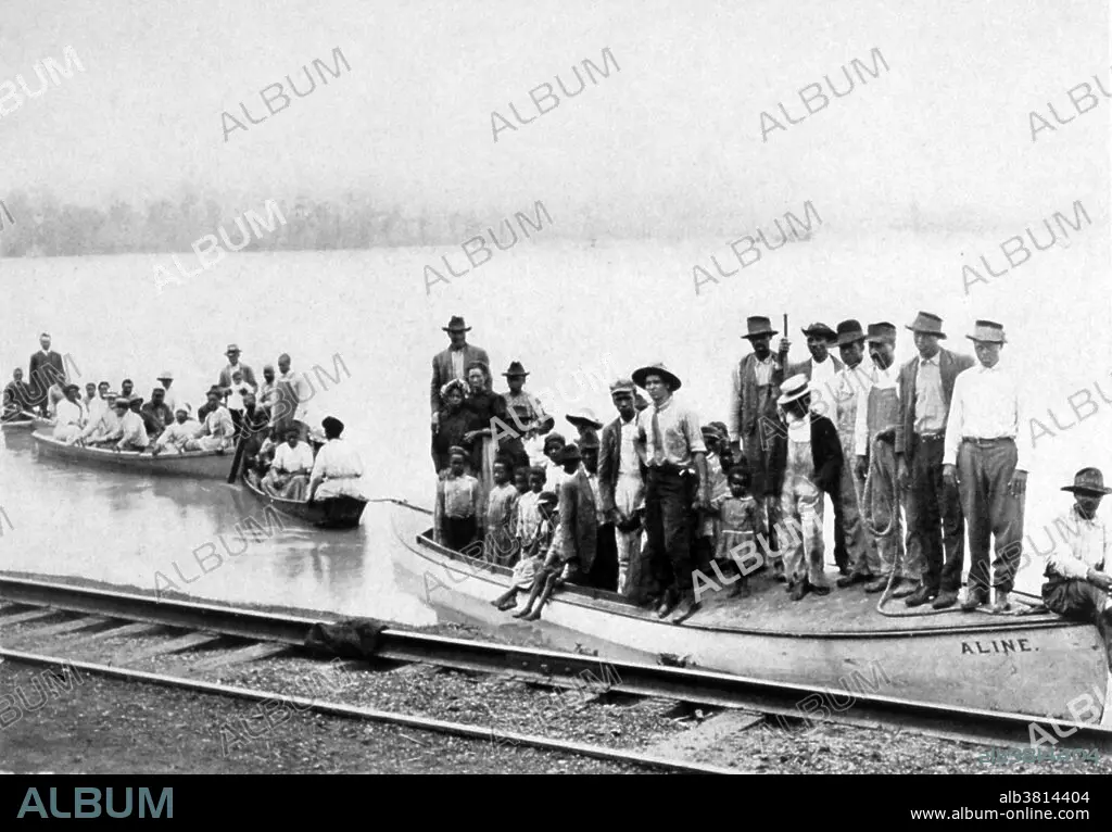
The Mississippi River is the chief river of the largest river system in North America. The Mississippi ranks as the fourth longest and tenth largest river in the world. The river either borders or cuts through the states of Minnesota, Wisconsin, Iowa, Illinois, Missouri, Kentucky, Tennessee, Arkansas, Mississippi, and Louisiana. The Mississippi drainage basin is the fifth largest in the world. Areal (rain related) flooding of the Mississippi occurs primarily in the southern states of Mississippi and Louisiana. Following the Great Flood of 1927, the Army Corps of Engineers was charged with taming the Mississippi River. Under the Flood Control Act of 1928, the world's longest system of levees was built. Floodways that diverted excessive flow from the Mississippi River were constructed. Photo originally captioned: "Refugees. Driven from their homes." In: "The Mississippi River Flood Problem," by John A. Fox, 1915.
The Mississippi River is the chief river of the largest river system in North America. The Mississippi ranks as the fourth longest and tenth largest river in the world. The river either borders or cuts through the states of Minnesota, Wisconsin, Iowa, Illinois, Missouri, Kentucky, Tennessee, Arkansas, Mississippi, and Louisiana. The Mississippi drainage basin is the fifth largest in the world. Areal (rain related) flooding of the Mississippi occurs primarily in the southern states of Mississippi and Louisiana. Following the Great Flood of 1927, the Army Corps of Engineers was charged with taming the Mississippi River. Under the Flood Control Act of 1928, the world's longest system of levees was built. Floodways that diverted excessive flow from the Mississippi River were constructed. Photo originally captioned: "Refugees. Driven from their homes." In: "The Mississippi River Flood Problem," by John A. Fox, 1915.
Crédito: Album / NOAA/Science Source
Autorizaciones: ? Cesión de modelo: No - ? Cesión de propiedad: No
¿Preguntas relacionadas con los derechos?
¿Preguntas relacionadas con los derechos?
Tamaño imagen: 5100 × 3551 px | 51.8 MB
Tamaño impresión: 43.2 × 30.1 cm | 2007.9 × 1398.0 in (300 dpi)
Palabras clave: 1915 • ACONTECIMIENTO • AMERICA • AMERICANO • ATMOSFERICO • BLANCO Y NEGRO • CATASTRÓFICOS • CIENCIA • CLIMA • DAÑADAS • DAÑADO • DAÑO • DAÑOS POR LA TEMPESTAD • DAÑOS • DESASTRE NATURAL • DESASTRE • DESTROZOS • DESTRUCCION • DESTRUCTIVOS • DESTRUÍDO • DEVASTACION • ESTADOS UNIDOS DE AMERICA • ESTADOS UNIDOS • FAMOSA • FAMOSO • FAMOSOS • FENÓMENO NATURAL • FENOMENOS NATURALES • FENÓMENOS • HISTORIA • HISTORICO • IMPORTANTE • INUNDACION • METEOROLOGÍA • METEOROLÓGICO • METEREOLOGIA • METEREOLÓGICOS • MORTAL • S. XX • SECUELAS • SIGLO XX • SIN TECHO • TORMENTA • VAGABUNDO • VARADOS • VIOLENTOS
