alb4088841
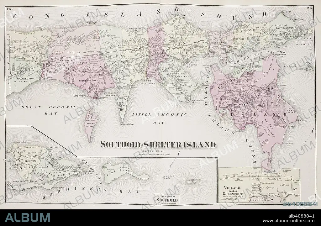
Map of Southold Shelter Island on Long Island New York in the United States. . Atlas of Long Island, New York. From recent and actual Surveys and Records under the superintendence of F.W. Beers. New York, 1873. Source: Maps.33.d.17 ff.178-179. Language: English.
| Compartir |
|---|
 Pinterest Pinterest |
 Twitter Twitter |
 Facebook Facebook |
 Copiar enlace Copiar enlace |
 Email Email |
|
Añadir a otro lightbox |
|
Añadir a otro lightbox |


¿Ya tienes cuenta? Iniciar sesión
¿No tienes cuenta? Regístrate
Compra esta imagen

Descripción:
Ver traducción automática
Map of Southold Shelter Island on Long Island New York in the United States. . Atlas of Long Island, New York. From recent and actual Surveys and Records under the superintendence of F.W. Beers. New York, 1873. Source: Maps.33.d.17 ff.178-179. Language: English.
Crédito:
Album / British Library
Autorizaciones:
Modelo: No - Propiedad: No
¿Preguntas relacionadas con los derechos?
¿Preguntas relacionadas con los derechos?
Tamaño imagen:
6952 x 4532 px | 90.1 MB
Tamaño impresión:
58.9 x 38.4 cm | 23.2 x 15.1 in (300 dpi)
Palabras clave:
AMÉRICA DEL NORTE • ARCHIPIÉLAGO • CARTOGRAFIA • CARTOGRAFICO • CIUDAD LAS VEGAS • ESTADOS UNIDOS • ESTILO Y PERIODO • ISLA • LONG ISLAND • MAPA • NEOYORQUINA • NEOYORQUINOS • NEW YORK • NORTEAMERICA • NUEVA YORK CIUDAD • NUEVA YORK • S. XIX • SIGLO XIX
