alb11511308
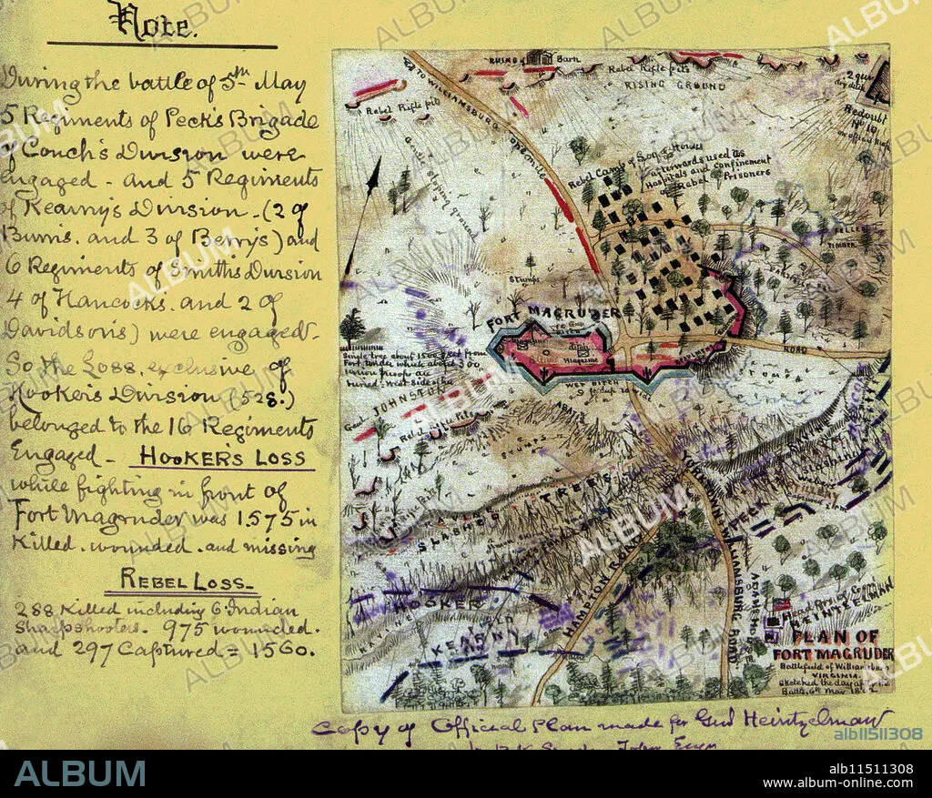
ROBERT KNOX SNEDEN. Plan of Fort Magruder, Battlefield of Williamsburg, Virginia
| Compartir |
|---|
 Pinterest Pinterest |
 Twitter Twitter |
 Facebook Facebook |
 Copiar enlace Copiar enlace |
 Email Email |
|
Añadir a otro lightbox |
|
Añadir a otro lightbox |


¿Ya tienes cuenta? Iniciar sesión
¿No tienes cuenta? Regístrate
Compra esta imagen.
Selecciona el uso:

Autor: ROBERT KNOX SNEDEN
Título: Plan of Fort Magruder, Battlefield of Williamsburg, Virginia
Descripción: Ver traducción automática
Plan of Fort Magruder, Battlefield of Williamsburg, Virginia. Sketched the day after the battle 6th May 1862.. the area surrounding Confederate Fort Magruder just south of in Williamsburg, Va. Details include the network of ravines and slashed trees extending the width of the Peninsula used by the Confederate Army as part of its defenses.
Plan of Fort Magruder, Battlefield of Williamsburg, Virginia. Sketched the day after the battle 6th May 1862.. the area surrounding Confederate Fort Magruder just south of in Williamsburg, Va. Details include the network of ravines and slashed trees extending the width of the Peninsula used by the Confederate Army as part of its defenses.
Crédito: Album / The Pierce Archive
Autorizaciones: ? Cesión de modelo: No - ? Cesión de propiedad: No
¿Preguntas relacionadas con los derechos?
¿Preguntas relacionadas con los derechos?
Tamaño imagen: 3090 × 2485 px | 22.0 MB
Tamaño impresión: 26.2 × 21.0 cm | 1216.5 × 978.3 in (300 dpi)
