alb8368420
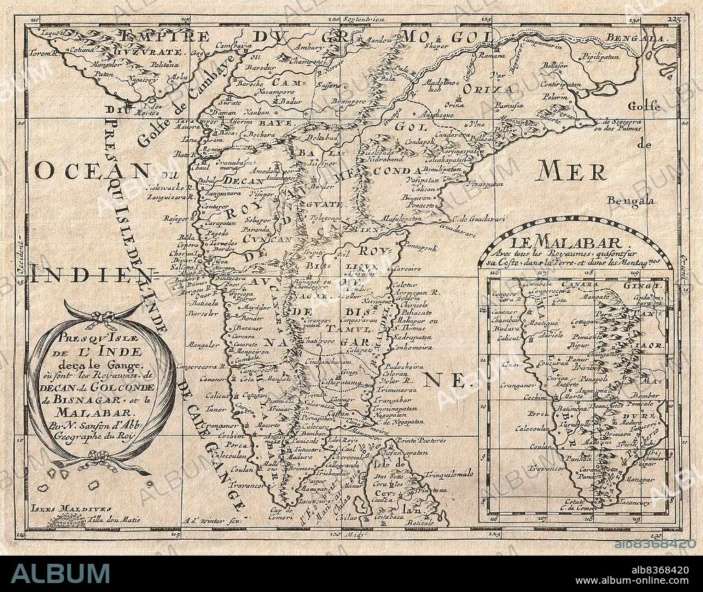
India: A French map of the Indian subcontinent and its myriad kingdoms (though most had fallen to ruin over 100 years prior) by Nicolas Sanson (1600-1667),1652. (Private Collection)
| Compartir |
|---|
 Pinterest Pinterest |
 Twitter Twitter |
 Facebook Facebook |
 Copiar enlace Copiar enlace |
 Email Email |
|
Añadir a otro lightbox |
|
Añadir a otro lightbox |


¿Ya tienes cuenta? Iniciar sesión
¿No tienes cuenta? Regístrate
Compra esta imagen

Título:
India: A French map of the Indian subcontinent and its myriad kingdoms (though most had fallen to ruin over 100 years prior) by Nicolas Sanson (1600-1667),1652. (Private Collection)
Descripción:
Ver traducción automática
Nicolas Sanson (1600-1667) was a French cartographer and geographer, credited by some as the creator of French geography and the father of French cartography.
Crédito:
Album / Universal Images Group / Pictures From History
Autorizaciones:
Modelo: No - Propiedad: No
¿Preguntas relacionadas con los derechos?
¿Preguntas relacionadas con los derechos?
Tamaño imagen:
4538 x 3583 px | 46.5 MB
Tamaño impresión:
38.4 x 30.3 cm | 15.1 x 11.9 in (300 dpi)
