alb3832840
Plate Boundaries, Earthquake and Volcano Zones
| Compartir |
|---|
 Pinterest Pinterest |
 Twitter Twitter |
 Facebook Facebook |
 Copiar enlace Copiar enlace |
 Email Email |
|
Añadir a otro lightbox |
|
Añadir a otro lightbox |


¿Ya tienes cuenta? Iniciar sesión
¿No tienes cuenta? Regístrate
Compra esta imagen

Título:
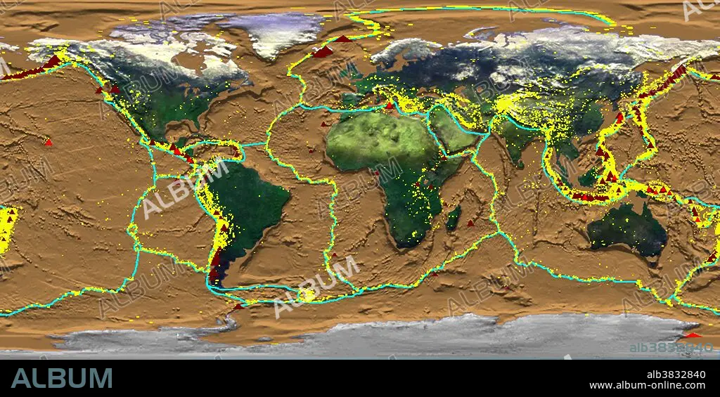
Plate Boundaries, Earthquake and Volcano Zones
Descripción:
Ver traducción automática
Crustal Dynamics showing earthquakes, plate boundaries, and volcanoes simultaneously. Produced for the Smithsonian Institution's HoloGlobe Exhibit which opened to the public on August 10, 1996 at the Museum of Natural History in Washington, DC. The various data sets show progressive global change mapped onto a rotating globe and projected into space to create a holographic image of the Earth. The exhibit shows that Earth's atmosphere, hydrosphere, geosphere, and biosphere are dynamic, changing on timescales of days, minutes, or even seconds.
Crédito:
Album / Science Source / NASA GSFC Scientific Visualization Studio
Autorizaciones:
Modelo: No - Propiedad: No
¿Preguntas relacionadas con los derechos?
¿Preguntas relacionadas con los derechos?
Tamaño imagen:
5100 x 2550 px | 37.2 MB
Tamaño impresión:
43.2 x 21.6 cm | 17.0 x 8.5 in (300 dpi)
Palabras clave:
CARTOGRAFIA • CIENCIA DE LA TIERRA • CIENCIA • DÉCADA DE 1990 • GEODESIA • GEOLOGIA • GEOLOGICO • MAPA • S. XX • SIGLO XX
