alb9378341
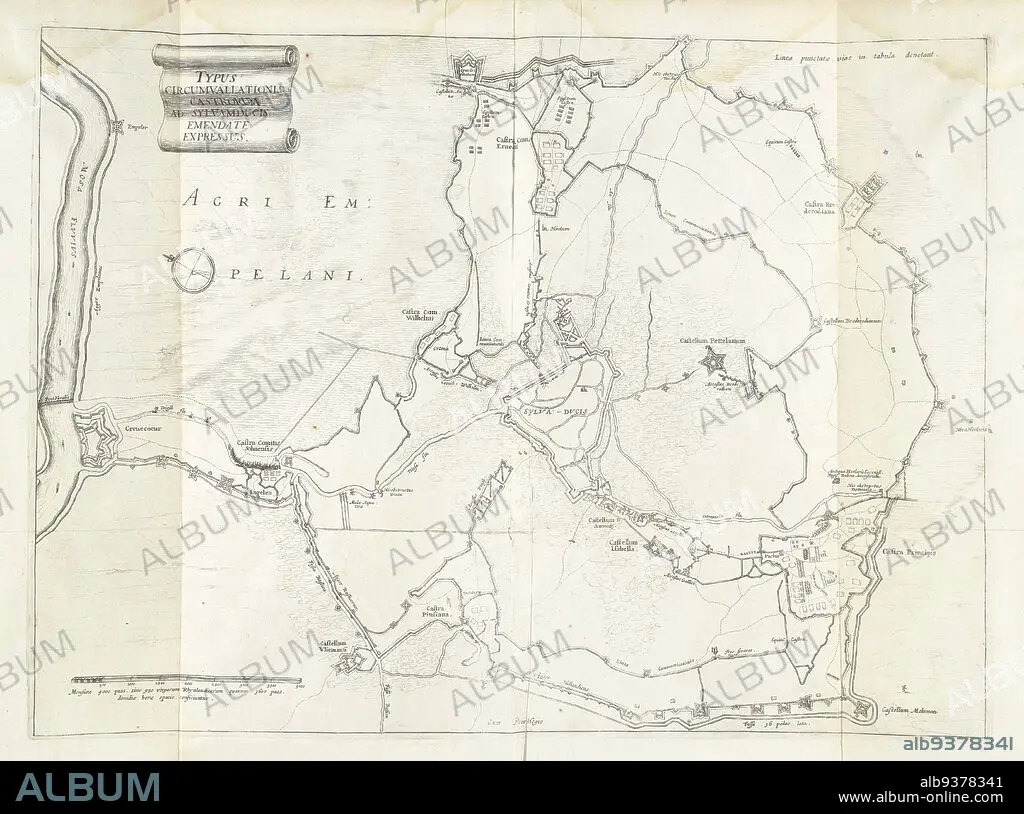
Encirclement of Den Bosch during the siege by Frederick Henry, 1629, Typus circumvallationis castrorum ad Sylvamducis, emendate expressus (title on object), Map of the encirclement of Den Bosch during the siege by the State army under Frederick Henry, from May 1 to September 17, 1629. On the left the fort Crèvecoeur on the Maas. Inscriptions in the representation in Latin., print maker: anonymous, Staten-Generaal, Northern Netherlands, 1629 - 1631, paper, etching, height 360 mm × width 493 mm.
| Compartir |
|---|
 Pinterest Pinterest |
 Twitter Twitter |
 Facebook Facebook |
 Copiar enlace Copiar enlace |
 Email Email |
|
Añadir a otro lightbox |
|
Añadir a otro lightbox |


¿Ya tienes cuenta? Iniciar sesión
¿No tienes cuenta? Regístrate
Compra esta imagen.
Selecciona el uso:

Descripción:
Ver traducción automática
Encirclement of Den Bosch during the siege by Frederick Henry, 1629, Typus circumvallationis castrorum ad Sylvamducis, emendate expressus (title on object), Map of the encirclement of Den Bosch during the siege by the State army under Frederick Henry, from May 1 to September 17, 1629. On the left the fort Crèvecoeur on the Maas. Inscriptions in the representation in Latin., print maker: anonymous, Staten-Generaal, Northern Netherlands, 1629 - 1631, paper, etching, height 360 mm × width 493 mm
Crédito:
Album / quintlox
Autorizaciones:
Modelo: No - Propiedad: No
¿Preguntas relacionadas con los derechos?
¿Preguntas relacionadas con los derechos?
Tamaño imagen:
5544 x 4122 px | 65.4 MB
Tamaño impresión:
46.9 x 34.9 cm | 18.5 x 13.7 in (300 dpi)
