alb4069074
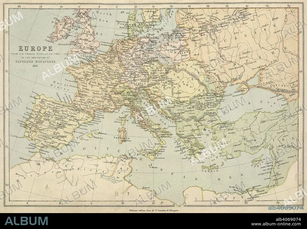
E WELLER. A map of Europe from the French Revolution (1793) to the abdication of Napoleon Bonaparte 1815. Collins' Series of Atlases. The Student's Atlas of Historical Geography, consisting of sixteen Maps, constructed and engraved by Edward Weller, F.R.G.S., and descriptive letterpress by W.F. Collier. With Index. London, Glasgow and Edinburgh : William Collins, Sons, & Co., 1873. Source: Maps 49.c.78, no.13. Language: English.
| Compartir |
|---|
 Pinterest Pinterest |
 Twitter Twitter |
 Facebook Facebook |
 Copiar enlace Copiar enlace |
 Email Email |
|
Añadir a otro lightbox |
|
Añadir a otro lightbox |


¿Ya tienes cuenta? Iniciar sesión
¿No tienes cuenta? Regístrate
Compra esta imagen

Autor:
Descripción:
Ver traducción automática
A map of Europe from the French Revolution (1793) to the abdication of Napoleon Bonaparte 1815. Collins' Series of Atlases. The Student's Atlas of Historical Geography, consisting of sixteen Maps, constructed and engraved by Edward Weller, F.R.G.S., and descriptive letterpress by W.F. Collier. With Index. London, Glasgow and Edinburgh : William Collins, Sons, & Co., 1873. Source: Maps 49.c.78, no.13. Language: English.
Crédito:
Album / British Library
Autorizaciones:
Modelo: No - Propiedad: No
¿Preguntas relacionadas con los derechos?
¿Preguntas relacionadas con los derechos?
Tamaño imagen:
6234 x 4323 px | 77.1 MB
Tamaño impresión:
52.8 x 36.6 cm | 20.8 x 14.4 in (300 dpi)
Palabras clave:
