alb1962708
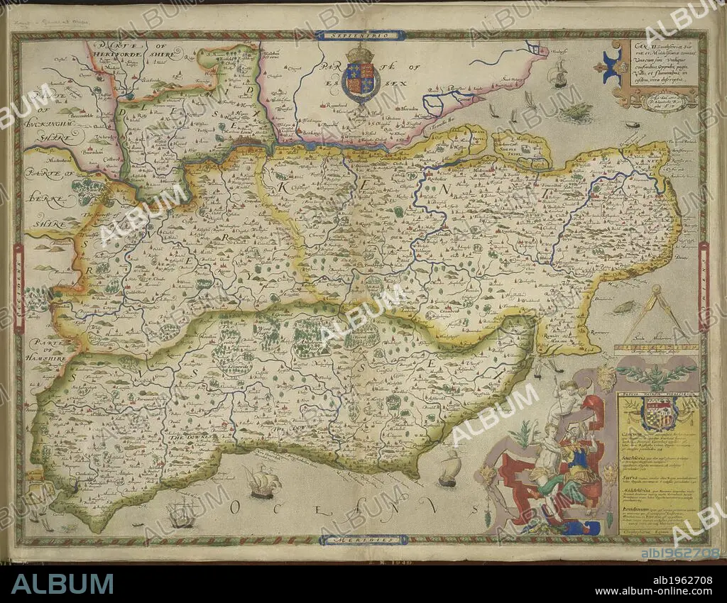
Sussex and Kent. An atlas of England and Wales, containing 35 colou. London, 1579. A map of Sussex and Kent, with parts of Essex, Buckinghamshire, Bekshire, Hampshire and Middlesex. Image taken from An atlas of England and Wales, containing 35 coloured maps, drawn by Christopher Saxton and engraved by A. Ryther, R. Hogenberg, C. Hogius, N. Reynolds, L. Terwoort and F. Scatter. Originally published/produced in 1579. Source: Maps.C.3.bb.5, f.11. Language: English.
| Compartir |
|---|
 Pinterest Pinterest |
 Twitter Twitter |
 Facebook Facebook |
 Copiar enlace Copiar enlace |
 Email Email |
|
Añadir a otro lightbox |
|
Añadir a otro lightbox |


¿Ya tienes cuenta? Iniciar sesión
¿No tienes cuenta? Regístrate
Compra esta imagen.
Selecciona el uso:

Descripción:
Ver traducción automática
Sussex and Kent. An atlas of England and Wales, containing 35 colou. London, 1579. A map of Sussex and Kent, with parts of Essex, Buckinghamshire, Bekshire, Hampshire and Middlesex. Image taken from An atlas of England and Wales, containing 35 coloured maps, drawn by Christopher Saxton and engraved by A. Ryther, R. Hogenberg, C. Hogius, N. Reynolds, L. Terwoort and F. Scatter. Originally published/produced in 1579. Source: Maps.C.3.bb.5, f.11. Language: English.
Crédito:
Album / British Library
Autorizaciones:
Modelo: No - Propiedad: No
¿Preguntas relacionadas con los derechos?
¿Preguntas relacionadas con los derechos?
Tamaño imagen:
5784 x 4503 px | 74.5 MB
Tamaño impresión:
49.0 x 38.1 cm | 19.3 x 15.0 in (300 dpi)
Palabras clave:
CARTOGRAFIA • EUROPA OCCIDENTAL • EUROPA • GRAN BRETAÑA • INGLATERRA • ISLAS BRITANICAS • KENT • MAPA • REINO UNIDO
