alb4088690
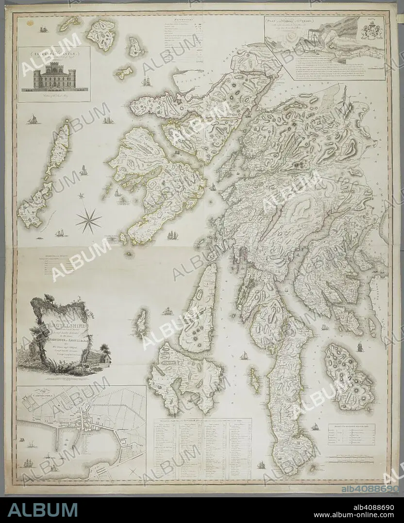
A map of Argyllshire. Map of Argyllshire, taken from actual survey, by G. Langlands and Son. Campbeltown, 1801. Source: Maps K.Top.49.25.2 TAB END. Language: English.
| Compartir |
|---|
 Pinterest Pinterest |
 Twitter Twitter |
 Facebook Facebook |
 Copiar enlace Copiar enlace |
 Email Email |
|
Añadir a otro lightbox |
|
Añadir a otro lightbox |


¿Ya tienes cuenta? Iniciar sesión
¿No tienes cuenta? Regístrate
Compra esta imagen.
Selecciona el uso:

Descripción: Ver traducción automática
A map of Argyllshire. Map of Argyllshire, taken from actual survey, by G. Langlands and Son. Campbeltown, 1801. Source: Maps K.Top.49.25.2 TAB END. Language: English.
A map of Argyllshire. Map of Argyllshire, taken from actual survey, by G. Langlands and Son. Campbeltown, 1801. Source: Maps K.Top.49.25.2 TAB END. Language: English.
Crédito: Album / British Library
Autorizaciones: ? Cesión de modelo: No - ? Cesión de propiedad: No
¿Preguntas relacionadas con los derechos?
¿Preguntas relacionadas con los derechos?
Tamaño imagen: 6095 × 7500 px | 130.8 MB
Tamaño impresión: 51.6 × 63.5 cm | 2399.6 × 2952.8 in (300 dpi)
Palabras clave: ALBION • CARTOGRAFIA • CARTOGRAFICO • ESCOCIA • GRAN BRETAÑA • INGLATERRA • ISLAS BRITANICAS • MAPA • MAPAS • REINO UNIDO • S. XIX • SIGLO XIX
