alb4067753
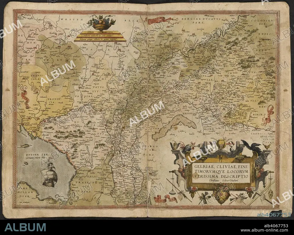
GERARDUS MERCATOR. Map of Gelderland and Cleves. The Mercator atlas of Europe. 1570-1572. Gelriae, Cliviae, fini timorumque locorum, verissima descriptio. Image taken from The Mercator atlas of Europe. Originally published/produced in 1570-1572. . Source: Maps.C.29.c.13, 17.
| Compartir |
|---|
 Pinterest Pinterest |
 Twitter Twitter |
 Facebook Facebook |
 Copiar enlace Copiar enlace |
 Email Email |
|
Añadir a otro lightbox |
|
Añadir a otro lightbox |


¿Ya tienes cuenta? Iniciar sesión
¿No tienes cuenta? Regístrate
Compra esta imagen.
Selecciona el uso:

Descripción: Ver traducción automática
Map of Gelderland and Cleves. The Mercator atlas of Europe. 1570-1572. Gelriae, Cliviae, fini timorumque locorum, verissima descriptio. Image taken from The Mercator atlas of Europe. Originally published/produced in 1570-1572. . Source: Maps.C.29.c.13, 17.
Map of Gelderland and Cleves. The Mercator atlas of Europe. 1570-1572. Gelriae, Cliviae, fini timorumque locorum, verissima descriptio. Image taken from The Mercator atlas of Europe. Originally published/produced in 1570-1572. . Source: Maps.C.29.c.13, 17.
Crédito: Album / British Library
Tamaño imagen: 6100 × 4549 px | 79.4 MB
Tamaño impresión: 51.6 × 38.5 cm | 2401.6 × 1790.9 in (300 dpi)
Palabras clave: EUROPA OCCIDENTAL • EUROPA • GÜELDRES • HOLANDA • MAPA • MAPAS • MERCATOR, GERHARD • PAISES BAJOS • SGROOTEN CHRISTIAN
