alb5366846
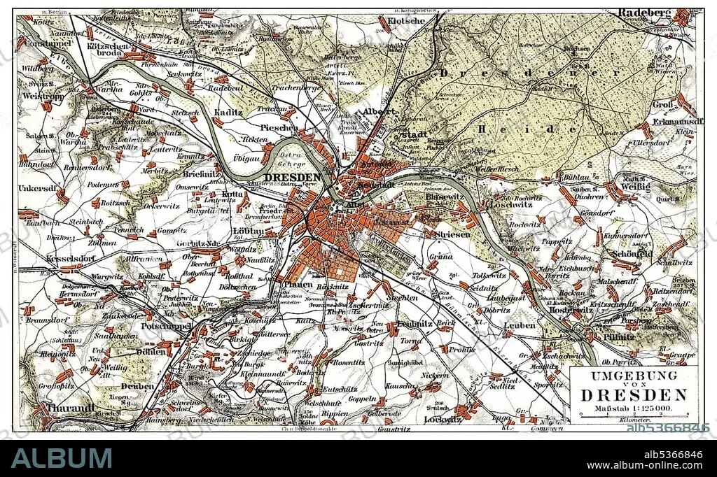
Map of Dresden and the surrounding area, Germany, Europe, end of the 19th Century, from Meyers Encyclopaedia, 1889
| Compartir |
|---|
 Pinterest Pinterest |
 Twitter Twitter |
 Facebook Facebook |
 Copiar enlace Copiar enlace |
 Email Email |
|
Añadir a otro lightbox |
|
Añadir a otro lightbox |


¿Ya tienes cuenta? Iniciar sesión
¿No tienes cuenta? Regístrate
Compra esta imagen.
Selecciona el uso:

Descripción: Ver traducción automática
Map of Dresden and the surrounding area, Germany, Europe, end of the 19th Century, from Meyers Encyclopaedia, 1889, Europe
Map of Dresden and the surrounding area, Germany, Europe, end of the 19th Century, from Meyers Encyclopaedia, 1889, Europe
Crédito: Album / ImageBroker / H.-D. Falkenstein
Autorizaciones: ? Cesión de modelo: No - ? Cesión de propiedad: No
¿Preguntas relacionadas con los derechos?
¿Preguntas relacionadas con los derechos?
Tamaño imagen: 5345 × 3282 px | 50.2 MB
Tamaño impresión: 45.3 × 27.8 cm | 2104.3 × 1292.1 in (300 dpi)
Palabras clave: ALEMANIA • CARTAS • CUADRO • CUADROS • EDAD • ENCICLOPEDIA • EUROPA • FIGURA • HISTORIA • HISTORICO • ILUSTRACION • ILUSTRACIONES • LABOR • LIBRO DE REFERENCIA • LIBRO • LIBROS • MAPA DE CARRETERAS • MAPA • PINTURA • PINTURAS • REPRESENTACIONES • REPUBLICA FEDERAL ALEMANA • SAJON • SAJONIA • SIGLO XIX • TARJETA • TARJETAS • TRABAJANDO • TRABAJO
