alb4056454
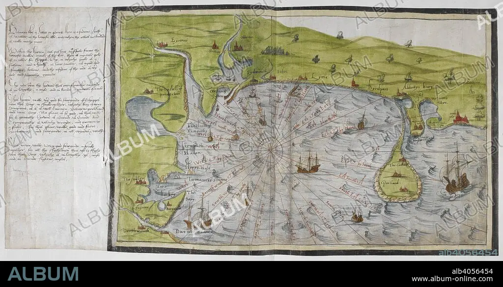
CHRISTOPHER SAXTON. Coloured manuscript map of the south coast of Devon and Dorset, from Dartmouth to Weymouth, with a description of Ottermouth Haven. Lord Burghley's Atlas. London; 1579. SAXTON, SAXTON's. Source: Royal 18 D. III, ff.9v-10. Language: English.
| Compartir |
|---|
 Pinterest Pinterest |
 Twitter Twitter |
 Facebook Facebook |
 Copiar enlace Copiar enlace |
 Email Email |
|
Añadir a otro lightbox |
|
Añadir a otro lightbox |


¿Ya tienes cuenta? Iniciar sesión
¿No tienes cuenta? Regístrate
Compra esta imagen

Descripción:
Ver traducción automática
Coloured manuscript map of the south coast of Devon and Dorset, from Dartmouth to Weymouth, with a description of Ottermouth Haven. Lord Burghley's Atlas. London; 1579. SAXTON, SAXTON's. Source: Royal 18 D. III, ff.9v-10. Language: English.
Crédito:
Album / British Library
Autorizaciones:
Modelo: No - Propiedad: No
¿Preguntas relacionadas con los derechos?
¿Preguntas relacionadas con los derechos?
Tamaño imagen:
7033 x 3654 px | 73.5 MB
Tamaño impresión:
59.5 x 30.9 cm | 23.4 x 12.2 in (300 dpi)
Palabras clave:
BARCO • BRUJULA • CARTOGRAFIA • DARMOUTH • DEVON • GRAN BRETAÑA • INGLATERRA • MAPA • S. XVI • SAXTON, CHRISTOPHER • SIGLO XVI • TRANSPORTE • WEYMOUTH
