alb3982105
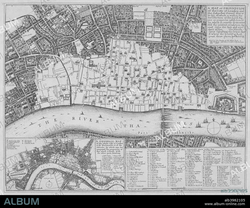
Map showing the extent of the damage caused by the Great Fire of London, 1666. Artist: Wenceslaus Hollar
| Compartir |
|---|
 Pinterest Pinterest |
 Twitter Twitter |
 Facebook Facebook |
 Copiar enlace Copiar enlace |
 Email Email |
|
Añadir a otro lightbox |
|
Añadir a otro lightbox |


¿Ya tienes cuenta? Iniciar sesión
¿No tienes cuenta? Regístrate
Compra esta imagen.
Selecciona el uso:

Título:
Map showing the extent of the damage caused by the Great Fire of London, 1666. Artist: Wenceslaus Hollar
Descripción:
Ver traducción automática
Map showing the extent of the damage caused by the Great Fire of London, 1666.
Personas:
Crédito:
Album / The London Archives (City of London)/Heritage Images
Autorizaciones:
Modelo: No - Propiedad: No
¿Preguntas relacionadas con los derechos?
¿Preguntas relacionadas con los derechos?
Tamaño imagen:
2834 x 2215 px | 18.0 MB
Tamaño impresión:
24.0 x 18.8 cm | 9.4 x 7.4 in (300 dpi)
Palabras clave:
ACONTECIMIENTO • BRITANICO • CARTOGRAFIA • CIUDAD DE LONDRES • CONCEPTO • DAÑO • DAÑOS • DESASTRE • DESTROZOS • DESTRUCCION • DEVASTACION • GEOGRAFIA • GRABADO • GRAN BRETAÑA • GUILDHALL LIBRARY & ART GALLERY • HOLLAR • INGLATERRA • INGLES • MAPA • PAÍS • RIO TAMESIS • RIO • SIGLO XVII • SIGLO • TAMESIS • WENCESLAUS HOLLAR
