alb9350285
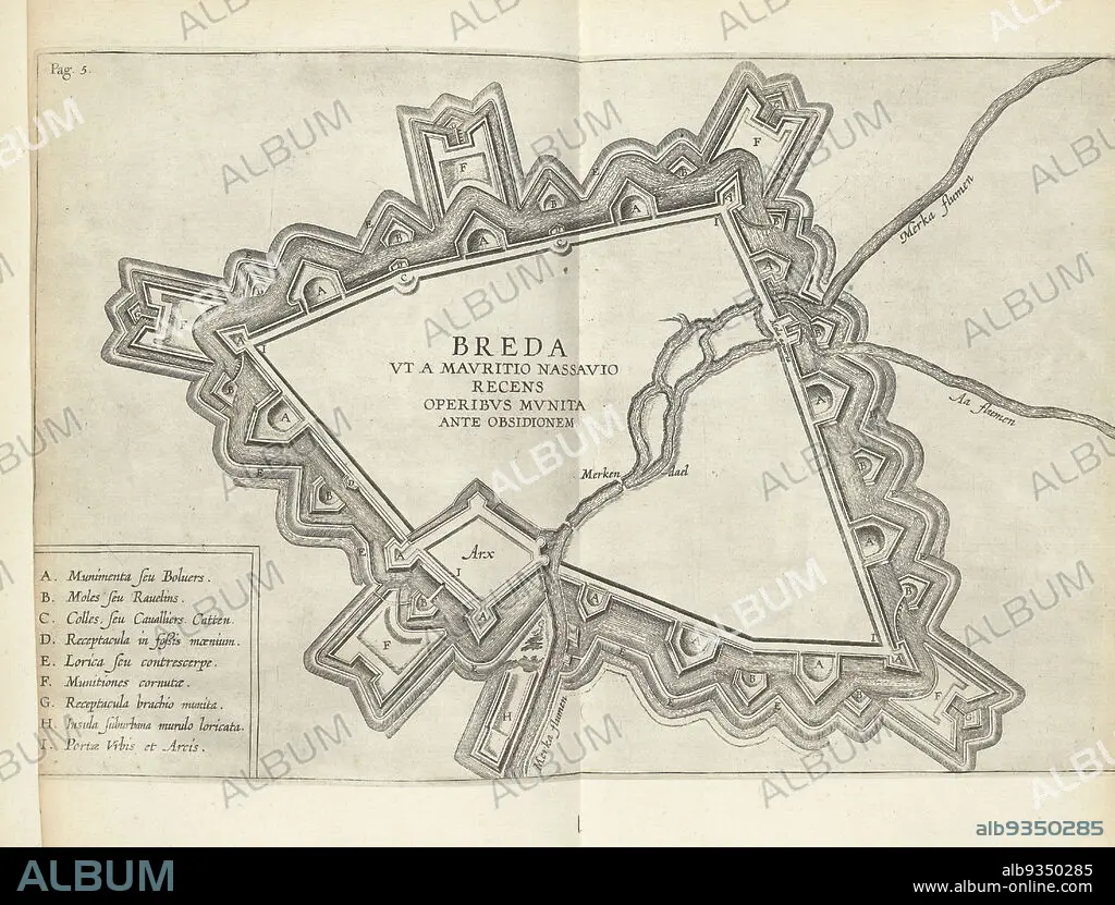
Map of Breda, 1624-1625, Breda ut a Mauritio Nassauio recens operibus munita ante obsionem (title on object), Map of Breda with the fortifications around the city constructed by Prince Maurits, 1624-1625. Bottom left legend A-I., print maker: anonymous, print maker: Theodoor Galle (possibly), Southern Netherlands, 1625 - 1626, paper, etching, height 236 mm × width 355 mm.
| Compartir |
|---|
 Pinterest Pinterest |
 Twitter Twitter |
 Facebook Facebook |
 Copiar enlace Copiar enlace |
 Email Email |
|
Añadir a otro lightbox |
|
Añadir a otro lightbox |


¿Ya tienes cuenta? Iniciar sesión
¿No tienes cuenta? Regístrate
Compra esta imagen.
Selecciona el uso:

Descripción:
Ver traducción automática
Map of Breda, 1624-1625, Breda ut a Mauritio Nassauio recens operibus munita ante obsionem (title on object), Map of Breda with the fortifications around the city constructed by Prince Maurits, 1624-1625. Bottom left legend A-I., print maker: anonymous, print maker: Theodoor Galle (possibly), Southern Netherlands, 1625 - 1626, paper, etching, height 236 mm × width 355 mm
Personas:
Crédito:
Album / quintlox
Autorizaciones:
Tamaño imagen:
4383 x 3328 px | 41.7 MB
Tamaño impresión:
37.1 x 28.2 cm | 14.6 x 11.1 in (300 dpi)
Palabras clave:
1625 • ANONIMA • ANONIMO • BREDA • FORTIFICACIONES • GRABADO • MAPA • MAPAS • PAPEL • THEODOOR GALLE
