alb9635617
JOHN DOWER. Plan of Constantinople and its Suburbs, 1856. Creator: John Dower.
| Compartir |
|---|
 Pinterest Pinterest |
 Twitter Twitter |
 Facebook Facebook |
 Copiar enlace Copiar enlace |
 Email Email |
|
Añadir a otro lightbox |
|
Añadir a otro lightbox |


¿Ya tienes cuenta? Iniciar sesión
¿No tienes cuenta? Regístrate
Compra esta imagen.
Selecciona el uso:

Autor:
Título:
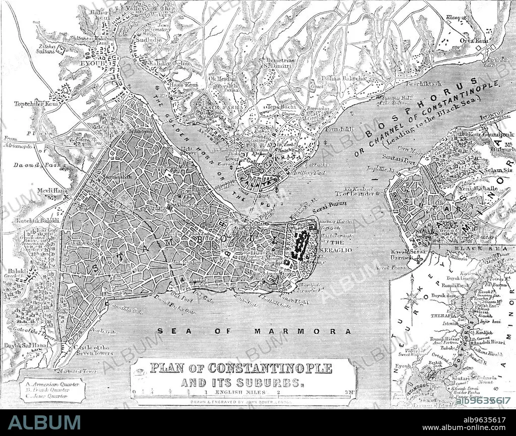
Plan of Constantinople and its Suburbs, 1856. Creator: John Dower.
Descripción:
Ver traducción automática
Plan of Constantinople and its Suburbs, 1856. Map showing the city of Constantinople (modern Istanbul, Turkey), including the 'Golden Horn or the Port'; the Bosphorus 'or Channel of Constantinople, leading to the Black Sea'; the Sea of Marmora, the 'Armenian, Frank and Jews' Quarters, pontoon bridge and the Seraglio. From "Illustrated London News", 1856.
Crédito:
Album /Heritage Images
Autorizaciones:
Tamaño imagen:
3607 x 2863 px | 29.5 MB
Tamaño impresión:
30.5 x 24.2 cm | 12.0 x 9.5 in (300 dpi)
Palabras clave:
ASIA MENOR • BLANCO Y NEGRO • BRITANICO • CIUDAD • COLOR • COLORIDO • CONSTANTINOPLA • COSTA • DOWER, JOHN • ESTAMBUL • GEOGRAFIA • GRABADO • GRAN BRETAÑA • ILLUSTRATED LONDON NEWS • LITORAL • MAPA • MAR • PAÍS • PAVO • PERIODICO • PRENSA • S. XIX • SIGLO XIX • SIGLO • TURCO
