alb5534006
India / Manipur: Map of Manipur and the Naga Hills, James Johnstone,1896.
| Compartir |
|---|
 Pinterest Pinterest |
 Twitter Twitter |
 Facebook Facebook |
 Copiar enlace Copiar enlace |
 Email Email |
|
Añadir a otro lightbox |
|
Añadir a otro lightbox |


¿Ya tienes cuenta? Iniciar sesión
¿No tienes cuenta? Regístrate
Compra esta imagen.
Selecciona el uso:

Título: India / Manipur: Map of Manipur and the Naga Hills, James Johnstone,1896.
Descripción: Ver traducción automática
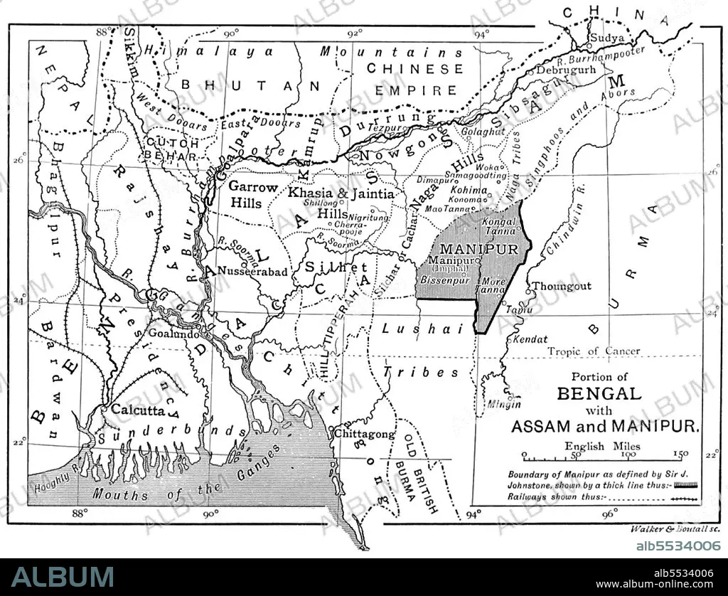
Manipur is a state in northeastern India, with the city of Imphal as its capital. Its people include the Meetei, Pangal (Muslims), Bishnupriya Manipuri's, Naga and Kuki who speak different languages of branches of the Tibeto-Burman family. The state is bounded by Nagaland to the north, Mizoram to the south, and Assam to the west; Burma lies to the east. It covers an area of 22,327 square kilometres (8,621 sq mi).
Manipur is a state in northeastern India, with the city of Imphal as its capital. Its people include the Meetei, Pangal (Muslims), Bishnupriya Manipuri's, Naga and Kuki who speak different languages of branches of the Tibeto-Burman family. The state is bounded by Nagaland to the north, Mizoram to the south, and Assam to the west; Burma lies to the east. It covers an area of 22,327 square kilometres (8,621 sq mi).
Crédito: Album / Pictures from History/Universal Images Group
Autorizaciones: ? Cesión de modelo: No - ? Cesión de propiedad: No
¿Preguntas relacionadas con los derechos?
¿Preguntas relacionadas con los derechos?
Tamaño imagen: 4700 × 3605 px | 48.5 MB
Tamaño impresión: 39.8 × 30.5 cm | 1850.4 × 1419.3 in (300 dpi)
