alb4523019
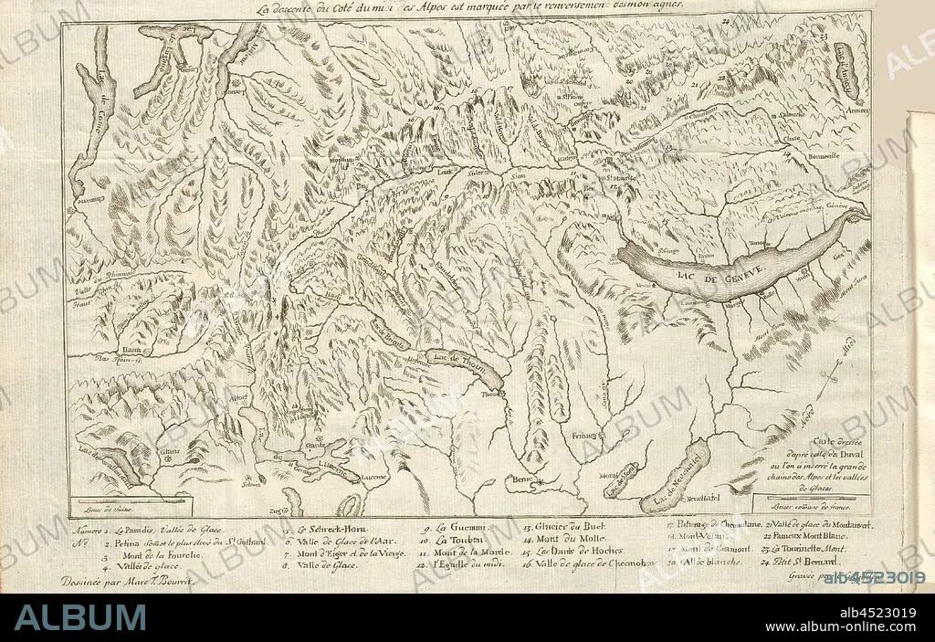
The descent of the Coté du Midi of the Alps is marked by the overthrow of the Montagens, Map: Southern Alps with Rhone Valley and Lake Geneva, Signed: Marc T. Bourrit; C.G. Geisler, etching, integrated into S. XIX (vol. 1), Bourrit, Marc-Théodore (dessinée); Geisler, C. G. (gravée), 1883, Bourrit, Marc-Théodore, Nouvelle description des Alpes. Genève: chez Paul Barde, 1783.
| Partager |
|---|
 Pinterest Pinterest |
 Twitter Twitter |
 Facebook Facebook |
 Copier le lien Copier le lien |
 Email Email |
|
Ajouter à une autre Lightbox |
|
Ajouter à une autre Lightbox |


Avez-vous déjà un compte? S'identifier
Vous n'avez pas de compte ? S'inscrire
Acheter cette image.
Sélectionnez l'usage:

Légende:
Voir la traduction automatique
The descent of the Coté du Midi of the Alps is marked by the overthrow of the Montagens, Map: Southern Alps with Rhone Valley and Lake Geneva, Signed: Marc T. Bourrit; C.G. Geisler, etching, integrated into S. XIX (vol. 1), Bourrit, Marc-Théodore (dessinée); Geisler, C. G. (gravée), 1883, Bourrit, Marc-Théodore, Nouvelle description des Alpes. Genève: chez Paul Barde, 1783
Crédit:
Album / quintlox
Autorisations:
Taille de l'image:
4573 x 2903 px | 38.0 MB
Taille d'impression:
38.7 x 24.6 cm | 15.2 x 9.7 in (300 dpi)
Mots clés:
