alb4067954
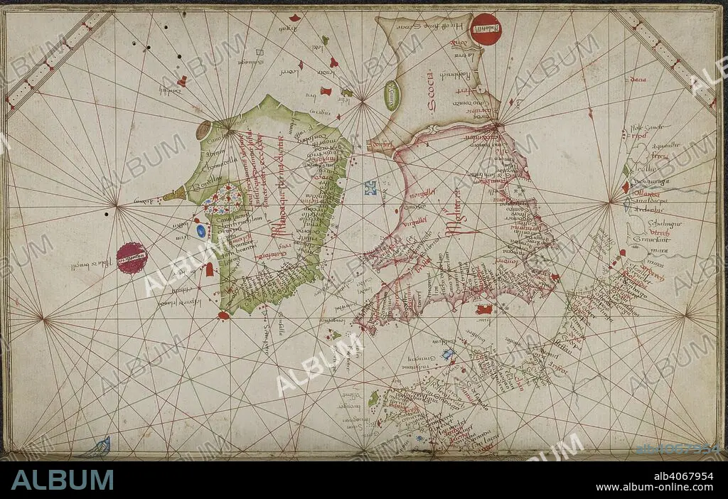
GRAZIOSO BENINCASA. Chart of the coasts of western Europe, from the British Isles to Portugal. Portolano. Italy; 1469. Source: Add. 31315, ff.4v-5. Language: Italian.
| Partager |
|---|
 Pinterest Pinterest |
 Twitter Twitter |
 Facebook Facebook |
 Copier le lien Copier le lien |
 Email Email |
|
Ajouter à une autre Lightbox |
|
Ajouter à une autre Lightbox |


Avez-vous déjà un compte? S'identifier
Vous n'avez pas de compte ? S'inscrire
Acheter cette image.
Sélectionnez l'usage:

Auteur:
Légende:
Voir la traduction automatique
Chart of the coasts of western Europe, from the British Isles to Portugal. Portolano. Italy; 1469. Source: Add. 31315, ff.4v-5. Language: Italian.
Crédit:
Album / British Library
Autorisations:
Taille de l'image:
6616 x 4190 px | 79.3 MB
Taille d'impression:
56.0 x 35.5 cm | 22.1 x 14.0 in (300 dpi)
Mots clés:
15 15E 15EME XV XVE XVEME SIECLE • 15E SIECLE • 15EME S • ANGLETARRE • ANGLETERE • ANGLETERRE • CARTE • CARTOGRAPHIE • CÔTE • EUROPE • GRANDE BERTAGNE • GRANDE BRETAGNE • GRANDE-BRETAGNE • GRAZIOSO BENINCASA • INGLATERRA • LITTORAL • MARITIME • QUINZIÈME SIÈCLE • ROYAUME UNI • ROYAUME-UNI • SCIENCE: CARTOGRAPHIE • XVE SIECLE
