alb3949099
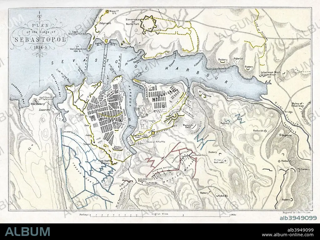
Map showing the Siege of Sevastopol, Crimean War, 1854-1855, (1893). Artist: Robert Walker
| Partager |
|---|
 Pinterest Pinterest |
 Twitter Twitter |
 Facebook Facebook |
 Copier le lien Copier le lien |
 Email Email |
|
Ajouter à une autre Lightbox |
|
Ajouter à une autre Lightbox |


Avez-vous déjà un compte? S'identifier
Vous n'avez pas de compte ? S'inscrire
Acheter cette image.
Sélectionnez l'usage:

Titre:
Map showing the Siege of Sevastopol, Crimean War, 1854-1855, (1893). Artist: Robert Walker
Légende:
Voir la traduction automatique
Map showing the Siege of Sevastopol, Crimean War, 1854-1855, (1893). The Siege of Sevastopol, lasted from September 1854 until September 1855. In September 1854, Allied troops (United Kingdom, French and Sardinian) landed in the Crimea and besieged the city of Sevastopol, home of the Tsar's Black Sea fleet which threatened the Mediterranean. An engraving from James Taylor's The Age We Live In: A History of the Nineteenth Century, From the Peace of 1815 to the Present Time, William Mackenzie, (London, 1893).
Personnalités:
Crédit:
Album / The Print Collector / Heritage Images
Autorisations:
Modèle: Non - Propriété: Non
Questions sur les droits?
Questions sur les droits?
Taille de l'image:
5010 x 3492 px | 50.1 MB
Taille d'impression:
42.4 x 29.6 cm | 16.7 x 11.6 in (300 dpi)
Mots clés:
CARTE • CARTOGRAPHIE • COULEUR • GEOGRAPHIE • GUERRE • ROBERT WALKER • SCIENCE: CARTOGRAPHIE • SEBASTOPOL • UKRAINE
